Ghindărești, Romania
11 memories from Ghindărești, Romania

This image depicts a view of the Danube River in Ghindărești, Romania, under a clear blue sky with the sun shining brightly. The sun creates a strong lens flare and a sparkling reflection on the water. The riverbank is lined with a sandy shore and dense green trees. Several houses are visible on the elevated land behind the trees, suggesting a residential area. On the sandy bank, there are two vehicles: a dark colored van and a lighter colored car. A single person, appearing as a small figure, is standing near the car on the left. A small, dark boat is partially visible on the water near the riverbank on the left side of the image. The water itself is a deep blue-green, with visible ripples and wave patterns, particularly where the sunlight reflects. The overall scene suggests a peaceful, sunny day by the river.
Ghindărești
The image shows a body of water with a treed bank in the background. The water is choppy and reflects the clear blue sky. On the bank, there are several trees of varying heights and densities. In the foreground of the bank, there are a few small boats moored. One white boat is tipped on its side, while a darker boat is upright. Further to the right, another dark boat is partially visible. The bank is covered in grass and scattered rocks. The overall scene suggests a natural setting, possibly a river or lake.
Ghindărești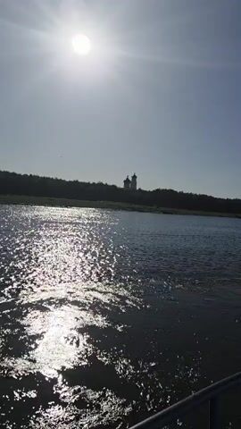
A wide shot shows a sunlit river with a distant treeline and a building with domes. The sun is high and bright, casting a glare on the water. The water is choppy, with light reflecting off the surface. A faint silhouette of trees is visible on the far bank, and on top of the trees, a building with two domes is visible. A single bird is flying in the sky. The bottom of the frame shows a railing.
Ghindărești
The image captures a tranquil scene on a body of water, likely a river or a lake, with a clear blue sky overhead. The sun is high in the sky, casting a bright glare on the water's surface, creating a shimmering effect. In the distance, a dense line of trees forms the backdrop, and a faint silhouette of a building with two domes, possibly a church, can be seen peeking above the treeline. Several birds are flying in the sky. In the foreground, a metal railing, part of a dock or a boat, is visible, indicating the perspective is from a vantage point near the water. The overall impression is one of natural beauty and serenity. The location is identified as Ghindărești, Romania.
Ghindărești
The image captures a serene natural scene at the edge of a body of water, likely a lake or river. The foreground is dominated by the calm, rippling surface of the water, reflecting the soft blue of the sky. The middle ground shows a narrow strip of dark, moist soil along the water's edge, with a scattering of debris. Beyond this, a gently sloping embankment is covered in lush green grass and scattered vegetation, with some areas appearing dry and golden. Further in the background, a dense band of trees and shrubs creates a rich, textured backdrop. A single, mature tree with dark green foliage stands prominently on the right side of the image, casting a shadow onto the embankment. The overall impression is one of a tranquil, undeveloped natural environment. The image does not contain any people or specific man-made structures that would pinpoint a location within the city of Ghindărești, Romania.
Ghindărești
The image shows a body of water in the foreground, with a shoreline dotted with rocks and vegetation. Behind the shoreline, a wooded hill rises, with a modern white building with many windows situated near its crest. A small, darker-roofed structure is visible nestled amongst trees to the left of the white building. A transmission tower with power lines is present on the right side of the frame, on the hill. The sky is clear and blue. The scene appears to be a waterfront landscape with some man-made structures. The image is taken from a low angle, likely from a boat on the water. The overall impression is one of a serene, natural environment with some modern infrastructure.
Ghindărești
The image shows two church domes and a bell tower rising above a treeline. The sky is clear and light blue. There are several birds flying in the sky. The scene appears to be a rural landscape. The location is Ghindărești, Romania.
Ghindărești
The image depicts an indoor scene, likely a kitchen or utility area, with two white refrigerators side-by-side. The left refrigerator is partially obscured by a wooden door frame and a hanging garment. Above the refrigerators, a dark pot with a copper handle sits on top of a black pan. To the right of the pot, a white plastic container with a lid and another white container with a blue label are visible. A plastic bag filled with white material is also on top of the refrigerators. The walls are paneled with a textured wallpaper, and a window with venetian blinds is present on the right side of the image. A white radiator with some clothing draped over it is situated near the window. The floor is made of wooden planks. Sunlight streams through the window, casting striped shadows across the refrigerators. Electrical outlets and a power cord are visible near the left refrigerator. The overall environment appears utilitarian and somewhat cluttered. The specific location in Ghindărești, Romania, is not visually evident from the image itself.
Ghindărești
The image depicts an interior scene, possibly an office or a living space with a workspace, located in Ghindărești, Romania. The room is furnished with a sectional sofa in a muted, possibly beige or light brown, color. In front of the sofa is a dark wooden coffee table with a worn or textured surface. On the table are a laptop, a small blue cup, an ashtray with cigarette butts, and a lighter. To the left of the sofa, a yellow hard hat is placed on a small shelf, beneath an icon of a man with a beard holding a cross. An air conditioning unit is mounted on the wall above the sofa. To the right of the sofa, a metal-framed shelf unit holds a printer on its top shelf, along with papers and office supplies. Below the printer, there are more papers, a red plastic bin, and a white radiator. The walls are paneled with wood-effect material, and the floor is covered with gray wood-look laminate flooring. The ceiling is also paneled and features fluorescent lighting and a dome-shaped light fixture. On a shelf to the far right, blue and yellow document binders are visible. The overall impression is one of a functional, perhaps somewhat dated, space.
Ghindărești
The image shows a view from an airplane window, looking out at the sky and clouds. The airplane's wing is visible in the foreground, with the Ryanair logo clearly displayed on the wingtip. There are also two black arrows painted on the wing, indicating a direction. The sky is a vibrant blue, with scattered white clouds below and to the left. The sun is shining brightly in the upper right corner, causing some lens flare. The overall scene depicts a typical airplane view during flight. There is no information within the image to suggest a specific location in Ghindărești, Romania.
Ghindărești
The image provides a detailed view from the navigation bridge of a boat, looking out over a wide river. The vessel appears to be actively underway, with instruments indicating navigation in progress during daytime under a partly cloudy sky. The location context of Ghindărești, Romania, places this scene on a major river, likely the Danube. Through the window, calm river water stretches towards distant banks lined with trees. A wiper blade is visible in the lower-left corner of the exterior view. Inside the helm, numerous objects and control systems are visible. A radar screen (Radio Holland) on the right displays yellow contacts and a blue track, indicating a range of "1.2/0.2km". Below it, a chart plotter running OpenCPN 5.6.2 shows a detailed map of a river with an "Island" and depth soundings like "sf dr 30.0" and "sf dr 34.0". The boat's current speed of "7.2 km/h" and a tracked path labeled "RUBISHIPS VI" are visible on this display. On the wooden console, a pair of grey binoculars with a black strap is placed next to a plastic water bottle with a blue cap. The bottle's label reads "Балдаран ИЗВОРНА ВОДА 1.5Le" (Baldaran Source Water 1.5L). Various control panels and gauges are mounted on the console. These include a rudder position indicator (ST-4950) marked with "RUDDER POSITION", "PORT", and "STBD", as well as analog gauges for "V" (voltage) and RPM. A paper note lists engine RPMs from "500 RPM" to "1200 RPM" with corresponding fuel consumption figures ranging from "13L" to "250L". Other visible text includes "FA-150 PWR", "33014", "021049", "Radio Holland" on a control unit, and a sticker for "DSU DIVING ASSOCIATION NV UNDERWATER SURVEYORS".
Ghindărești