Woburn, United Kingdom
5 memories from Woburn, United Kingdom
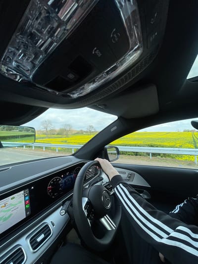
The image shows the interior of a car, from the driver's perspective. The driver is holding the steering wheel with their right hand and their left arm is resting on the seat. The driver is wearing a black jacket with white stripes. The dashboard shows a digital display with a speedometer, a temperature gauge, and a navigation system. The car is traveling on a road with a yellow field on the right side. There is a metal fence separating the road from the field. The car is driving towards a row of trees in the distance. The GPS shows a location that is in close proximity to the city of Woburn, United Kingdom, which is located at a latitude of 51.99 and a longitude of -0.618. The coordinates provided indicate a rural setting, likely in a field area outside of the main town center. The sky is cloudy. The car's interior is illuminated by natural light. The overhead light is off. The driver's side window is down, and the interior mirror is tilted. The dashboard is displaying a number of 37. The rearview mirror is visible. The steering wheel is leather-wrapped with a silver emblem. The buttons on the overhead console indicate an SOS function, a microphone, and a button labelled 'SOS'. The door handle has a button. The seat is covered in a dark fabric. The car has a black interior.
Woburn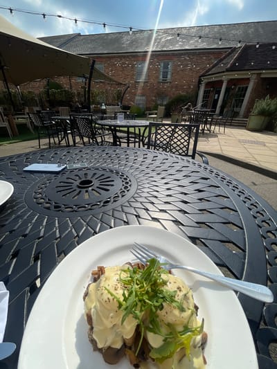
The image shows a plate of food, a white plate with two poached eggs with hollandaise sauce and mushrooms, on top of a black metal table with a circular pattern. There are other black metal chairs and tables around the table, as well as a white table with a blue phone and a white object on it. The background shows a brick building with a tan awning over a patio area with a light green grassy area between the building and the table. There are some trees and bushes visible. It is a sunny day, and the light shines through the awning. The location is at latitude 51.989, longitude -0.619, but this location does not correspond to a recognizable place in Woburn, United Kingdom. The coordinates may be incorrect or Woburn may not have an address that corresponds to the image location.
Woburn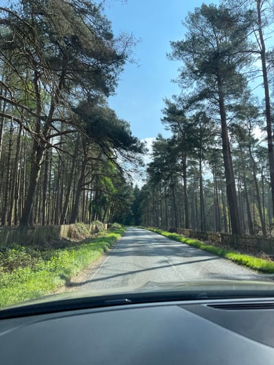
The image shows a view from inside a vehicle driving down a paved road through a forest. The road is straight and lined with tall pine trees on both sides, creating a tunnel-like effect. The road is shaded by the trees and a light breeze is blowing through the branches. There is a wooden fence on both sides of the road and grass growing on the sides. The sun is shining in the blue sky, casting long shadows of the trees on the road. The coordinates provided (latitude: 51.985, longitude: -0.664) do not correspond to a location in Woburn, UK. Woburn is in Bedfordshire, UK, and has coordinates approximately (latitude: 51.9802, longitude: -0.6474). The image appears to show a wooded area in a rural setting, potentially near the town of Woburn.
Woburn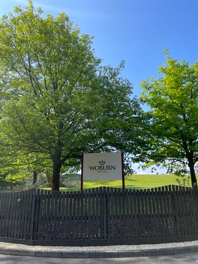
The image shows a wooden fence with a sign that reads "Woburn Golf Club" in front of a golf course. Two large green trees stand in the foreground, with a smaller, thinner tree in the background. There are people in the background on the golf course. The sky is blue. The scene is located near Woburn Golf Club, in Woburn, Bedfordshire, UK. The coordinates (latitude: 51.991, longitude: -0.663) are consistent with the location of Woburn Golf Club.
Woburn
The image shows a wooden fence with a sign attached to it. The sign is white with black lettering and depicts a crown above the word "WOBURN" and below the words "Golf Club." The sign is attached to a maroon post. Behind the fence, there is a grassy area. The fence is made of vertical wooden boards that are closely spaced. There is a small patch of gravel visible at the bottom of the image. The coordinates provided (latitude: 51.99, longitude: -0.662) place the location in the city of Woburn, Bedfordshire, United Kingdom. There are no people visible in the image.
Woburn