Sign in
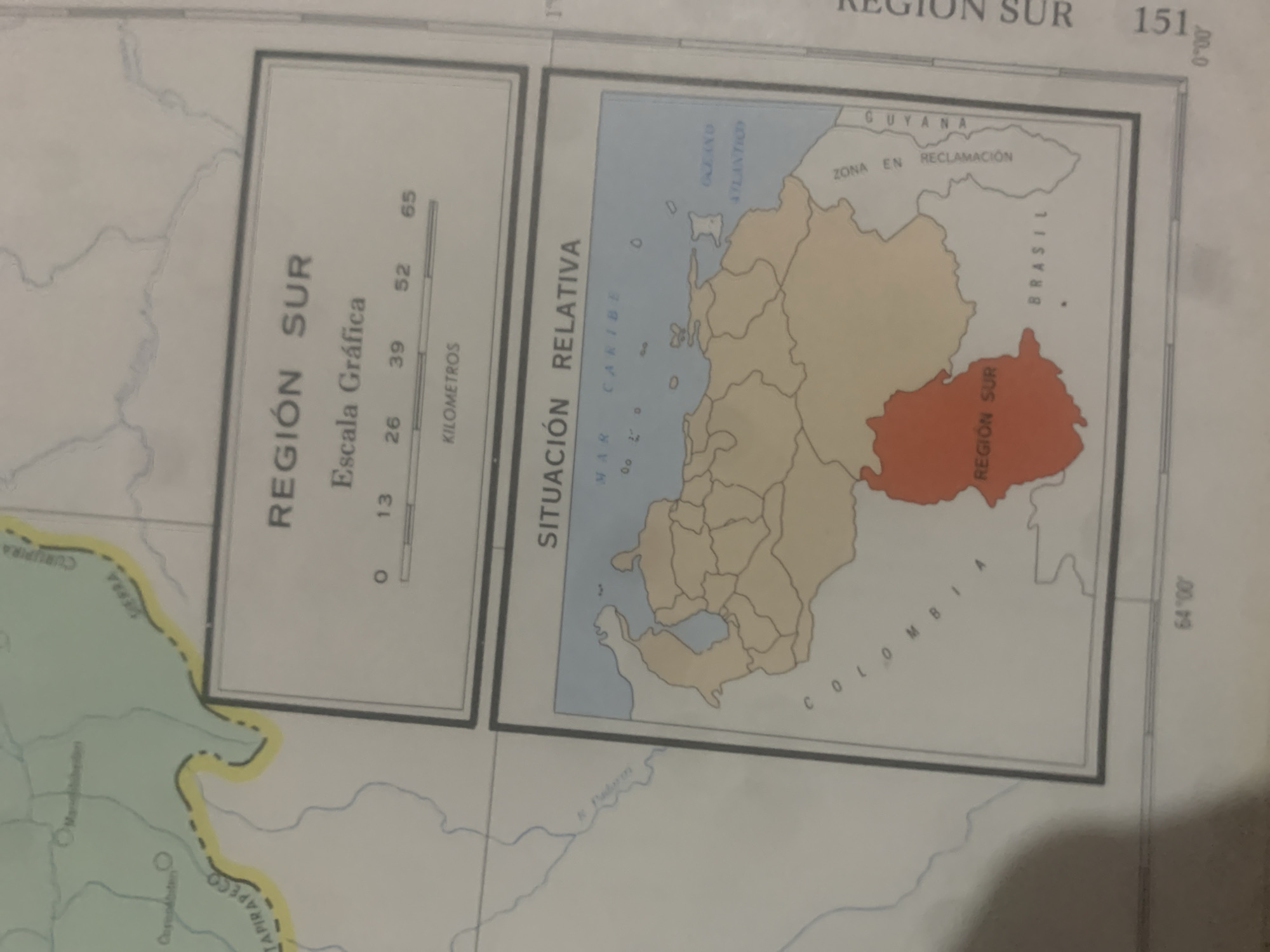
The media file is a photograph of a map, likely from a book or atlas. The map depicts a region labeled "REGIÓN SUR" in Spanish. It shows geographical features such as bodies of water, national borders, and a shaded area highlighting a specific territory. Text on the map includes place names like "CURUPIRA," "ERRA," "TAPIRAPECO," "MAR CARIBE," "OCEANO ATLANTICO," "GUYANA," "ZONA EN RECLAMACIÓN," and "BRASIL." A graphic scale is provided with the label "Escala Gráfica" and marks for "KILOMETROS." Coordinates and other numerical labels are also visible. The map is displayed in a way that suggests it is part of a larger publication, as evidenced by the cropping and the presence of a faint outline of what could be a page edge or binding. The image appears to be taken in daylight, with no significant shadows or lighting effects that would indicate a specific time of day or weather conditions. The focus is entirely on the map itself, with no people, animals, or other living subjects present. The overall impression is that of an educational or informational document.
bombolico

Jun 25, 2026, 2:49 PM

La Tagua, Venezuela

BLOCKED

Stake attention in this memory

informative
educational
detailed
geographical
neutral

The media file is a photograph of a map, likely from a book or atlas. The map depicts a region labeled "REGIÓN SUR" in Spanish. It shows geographical features such as bodies of water, national borders, and a shaded area highlighting a specific territory. Text on the map includes place names like "CURUPIRA," "ERRA," "TAPIRAPECO," "MAR CARIBE," "OCEANO ATLANTICO," "GUYANA," "ZONA EN RECLAMACIÓN," and "BRASIL." A graphic scale is provided with the label "Escala Gráfica" and marks for "KILOMETROS." Coordinates and other numerical labels are also visible. The map is displayed in a way that suggests it is part of a larger publication, as evidenced by the cropping and the presence of a faint outline of what could be a page edge or binding. The image appears to be taken in daylight, with no significant shadows or lighting effects that would indicate a specific time of day or weather conditions. The focus is entirely on the map itself, with no people, animals, or other living subjects present. The overall impression is that of an educational or informational document.

Symbol

012BC

Volume

11,550

Creator

+$0.09

Revenue

+$0.15

TVL

$7.35

1D
1W
1M
All

Loading AttnAds…

transactions
revenues
stakers
Earliest
Latest
Highest stake

1

RIKO

Staked 11d ago

$7.27 USD

+$0.08 USD

+1%

2

Rev Bot 🤖💰

Injected revenue 11d ago

Revenue bonus for the last stake.

+$0.17 USD

More from this user

More from La Tagua

bombolico

Jun 25, 2026, 2:49 PM

La Tagua, Venezuela

Licensed under Creative Commons Attribution 4.0 International License. You are free to share and adapt this content with proper attribution.