
Sign in
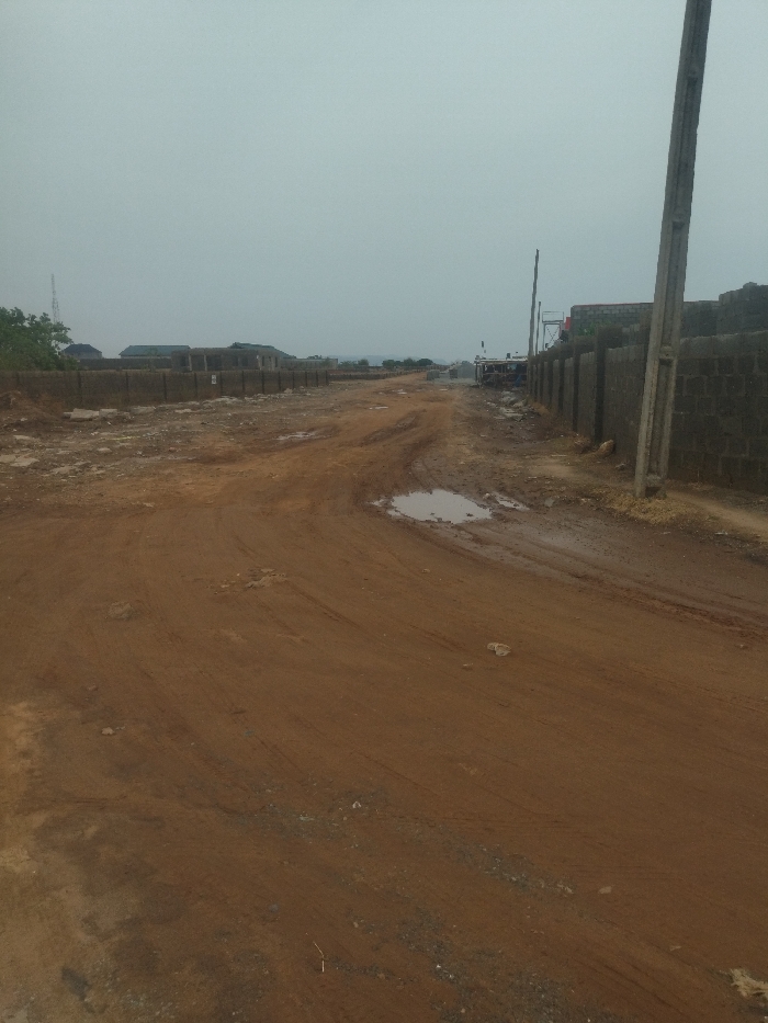
The image shows a dirt road in a developing area of Abuja, Nigeria, located at latitude: 8.966, longitude: 7.556. The road is unpaved and has deep tire tracks from recent use. There are a few puddles of water present, indicating recent rainfall. The road leads towards a row of concrete block walls on the right side of the image, likely bordering residential properties. The area appears to be under construction, with unfinished buildings visible in the distance. The sky is overcast and grey, suggesting a cloudy day. There are no people or vehicles present in the image.
FM-fHbIm2

Apr 10, 2025, 3:14 PM

Abuja, Nigeria

Stake attention in this memory

lonely
desolate
empty
uncertain
rugged

The image shows a dirt road in a developing area of Abuja, Nigeria, located at latitude: 8.966, longitude: 7.556. The road is unpaved and has deep tire tracks from recent use. There are a few puddles of water present, indicating recent rainfall. The road leads towards a row of concrete block walls on the right side of the image, likely bordering residential properties. The area appears to be under construction, with unfinished buildings visible in the distance. The sky is overcast and grey, suggesting a cloudy day. There are no people or vehicles present in the image.

Loading AttnAds…

transactions
revenues
stakers
Earliest
Latest
Highest stake

No transactions found
More from this user

More from Abuja

FM-fHbIm2

Apr 10, 2025, 3:14 PM

Abuja, Nigeria

Licensed under Creative Commons Attribution 4.0 International License. You are free to share and adapt this content with proper attribution.