Stake attention in this memory
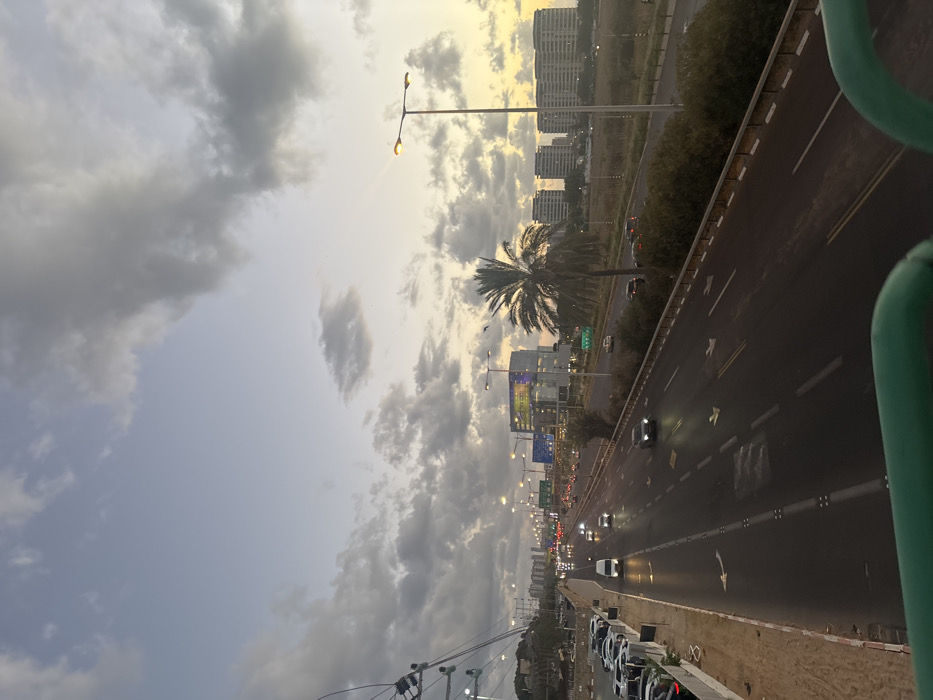
The image depicts an elevated view of a multi-lane highway at dusk or dawn, looking south-southeast. The scene is located along Highway 20 (Ayalon Highway) in the vicinity of Ramat HaSharon and Herzliya, Israel, likely near the Glilot Interchange, with the Microsoft Israel Development Center visible on the right. In the immediate foreground, a green metal railing indicates the elevated vantage point, possibly a pedestrian bridge or overpass. The central subject is a multi-lane asphalt highway, divided by painted lines and concrete barriers. Multiple vehicles are visible on the highway, with headlights illuminated, suggesting active traffic flow. White arrow markings are present on the road surface. To the left of the highway, an unpaved shoulder with sand and dirt leads to a large parking area filled with numerous parked cars. Above this area, utility poles and power lines are visible. Further in the distance, more urban development, including buildings, can be observed. To the right of the highway, a strip of dense green bushes and vegetation runs parallel to the road. Multiple streetlights with illuminated yellow-orange bulbs are spaced along the highway's edge. A prominent date palm tree stands tall between the highway and a cluster of buildings in the mid-distance. Directly behind the palm tree and to its left, a modern, multi-story commercial building with an illuminated facade displaying a large blue and yellow graphic is clearly visible (identified as the Microsoft Israel Development Center). Further to the right, a series of multi-story residential buildings with flat roofs extend towards the horizon. The sky is partially cloudy, featuring a mix of grey and white clouds. Near the horizon on the right, the sky exhibits a warm gradient of yellow and orange hues, transitioning to a lighter blue overhead, consistent with either sunrise or sunset. Two small dark specks, possibly birds, are visible in the sky above the palm tree.
Loading AttnAds…
No transactions found