Sign in
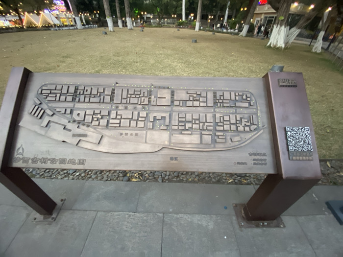
The image captures a ground-level view of a large, metallic brown information stand in what appears to be a park or public square. The main feature of the stand is a raised, three-dimensional relief map depicting a layout of buildings and streets, suggesting a historical village or district. The map itself is a metallic brown with lighter accents indicating paths or open spaces, and numerous small rectangular blocks representing structures.

In the background, a grassy area stretches out, dotted with trees, some of which have white-painted trunks. Artificial lights are visible throughout the background, illuminating what might be tents or decorative structures, indicating it is evening or night. A few blurry figures of people can be seen in the distance, walking or standing. The ground around the map stand consists of grey paving stones and a strip of gravel.

Visible text on the map stand includes:
*   At the bottom left of the map: "沙面古村公园地图" (Shāmiàn Gǔcūn Gōngyuán Dìtú), which translates to "Shamian Ancient Village Park Map."
*   On the right, next to a prominent QR code, the characters "扫码导航" (Sǎomǎ Dǎoháng), meaning "Scan code for navigation."
*   A larger title on the vertical panel to the right, though partially obscured and blurred, appears to include "沙面" (Shāmiàn).
*   Smaller, illegible text and numbers are present on the lower right of the map surface, likely legends or credits.

The scene suggests a peaceful, illuminated public space at night, likely a popular spot for leisure or tourism, with the map serving as a navigational aid for visitors exploring the "Shamian Ancient Village Park" in Guangzhou, China.
F
FM-CaIMM2

Jan 10, 2025, 10:06 AM

Guang Zhou Shi, China

Stake attention in this memory

The image captures a ground-level view of a large, metallic brown information stand in what appears to be a park or public square. The main feature of the stand is a raised, three-dimensional relief map depicting a layout of buildings and streets, suggesting a historical village or district. The map itself is a metallic brown with lighter accents indicating paths or open spaces, and numerous small rectangular blocks representing structures. In the background, a grassy area stretches out, dotted with trees, some of which have white-painted trunks. Artificial lights are visible throughout the background, illuminating what might be tents or decorative structures, indicating it is evening or night. A few blurry figures of people can be seen in the distance, walking or standing. The ground around the map stand consists of grey paving stones and a strip of gravel. Visible text on the map stand includes: * At the bottom left of the map: "沙面古村公园地图" (Shāmiàn Gǔcūn Gōngyuán Dìtú), which translates to "Shamian Ancient Village Park Map." * On the right, next to a prominent QR code, the characters "扫码导航" (Sǎomǎ Dǎoháng), meaning "Scan code for navigation." * A larger title on the vertical panel to the right, though partially obscured and blurred, appears to include "沙面" (Shāmiàn). * Smaller, illegible text and numbers are present on the lower right of the map surface, likely legends or credits. The scene suggests a peaceful, illuminated public space at night, likely a popular spot for leisure or tourism, with the map serving as a navigational aid for visitors exploring the "Shamian Ancient Village Park" in Guangzhou, China.

Loading AttnAds…

transactions
revenues
stakers
Earliest
Latest
Highest stake

No transactions found

More from this user

More from Guang Zhou Shi

FFM-CaIMM2

Jan 10, 2025, 10:06 AM

Guang Zhou Shi, China

Licensed under Creative Commons Attribution 4.0 International License. You are free to share and adapt this content with proper attribution.