Stake attention in this memory
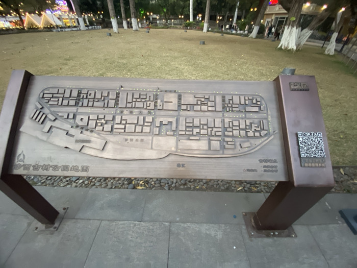
The image captures a ground-level view of a large, metallic brown information stand in what appears to be a park or public square. The main feature of the stand is a raised, three-dimensional relief map depicting a layout of buildings and streets, suggesting a historical village or district. The map itself is a metallic brown with lighter accents indicating paths or open spaces, and numerous small rectangular blocks representing structures. In the background, a grassy area stretches out, dotted with trees, some of which have white-painted trunks. Artificial lights are visible throughout the background, illuminating what might be tents or decorative structures, indicating it is evening or night. A few blurry figures of people can be seen in the distance, walking or standing. The ground around the map stand consists of grey paving stones and a strip of gravel. Visible text on the map stand includes: * At the bottom left of the map: "沙面古村公园地图" (Shāmiàn Gǔcūn Gōngyuán Dìtú), which translates to "Shamian Ancient Village Park Map." * On the right, next to a prominent QR code, the characters "扫码导航" (Sǎomǎ Dǎoháng), meaning "Scan code for navigation." * A larger title on the vertical panel to the right, though partially obscured and blurred, appears to include "沙面" (Shāmiàn). * Smaller, illegible text and numbers are present on the lower right of the map surface, likely legends or credits. The scene suggests a peaceful, illuminated public space at night, likely a popular spot for leisure or tourism, with the map serving as a navigational aid for visitors exploring the "Shamian Ancient Village Park" in Guangzhou, China.
Loading AttnAds…
No transactions found