Stake attention in this memory
untagged
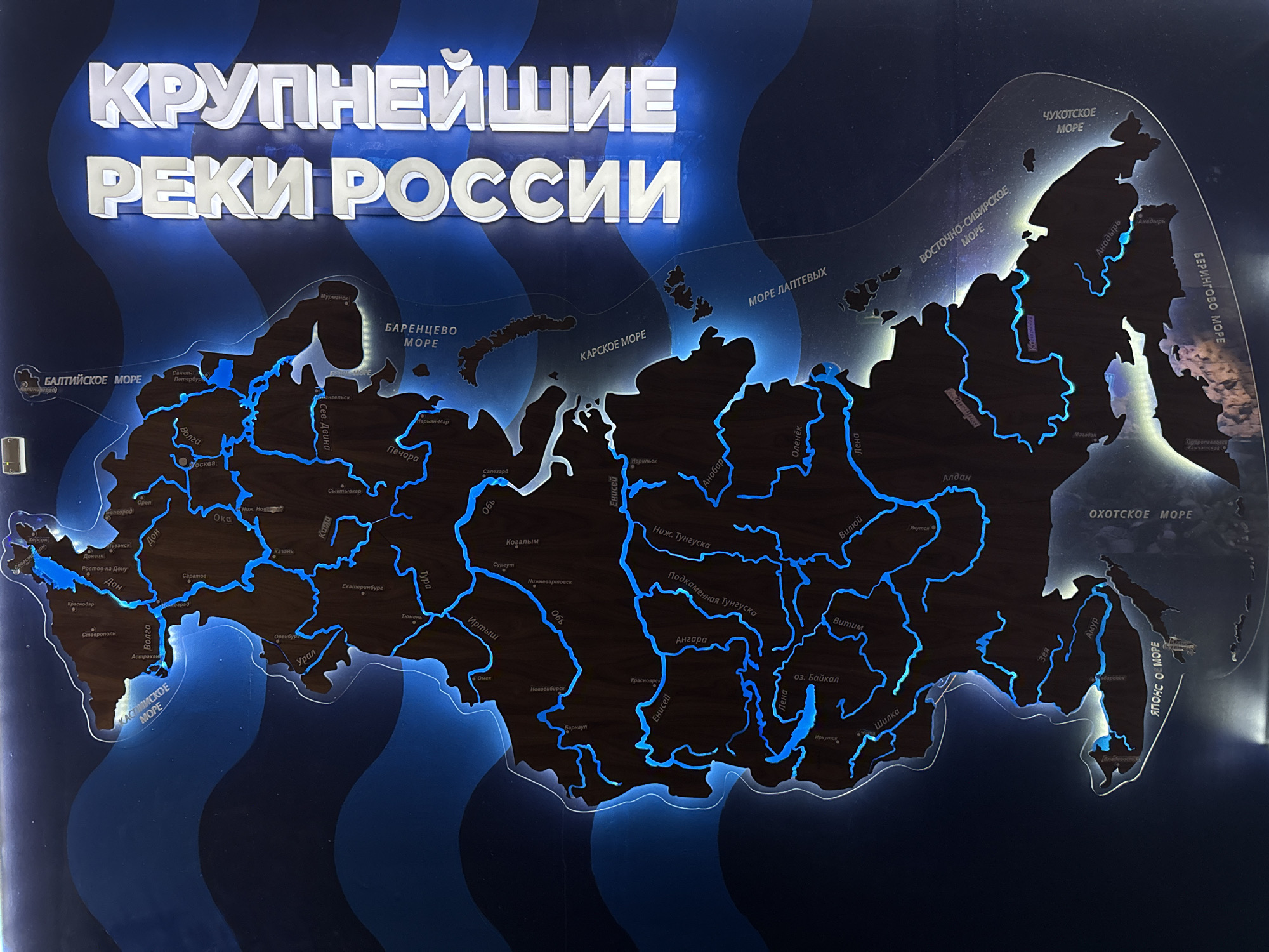
The image shows an illuminated map of Russia highlighting the major rivers. The map features the country's geographical outline with blue lines indicating the rivers, and city names are labeled in white. Surrounding seas, such as the Baltic Sea, Barents Sea, Kara Sea, Laptev Sea, East Siberian Sea, Chukchi Sea, Bering Sea, Okhotsk Sea, and the Sea of Japan, are also marked. The title at the top reads "КРУПНЕЙШИЕ РЕКИ РОССИИ" ("Largest Rivers of Russia" in English) in white, 3D lettering. Although city names are visible, there is no specific indication that this is located in Kogalym, Russia.
Symbol
0739C
Volume
2,195
Creator
+$0.00
Revenue
+$0.00
TVL
$0.14
1D
1W
1M
All
Loading AttnAds…
transactions
revenues
stakers
Earliest
Latest
Highest stake