Sign in
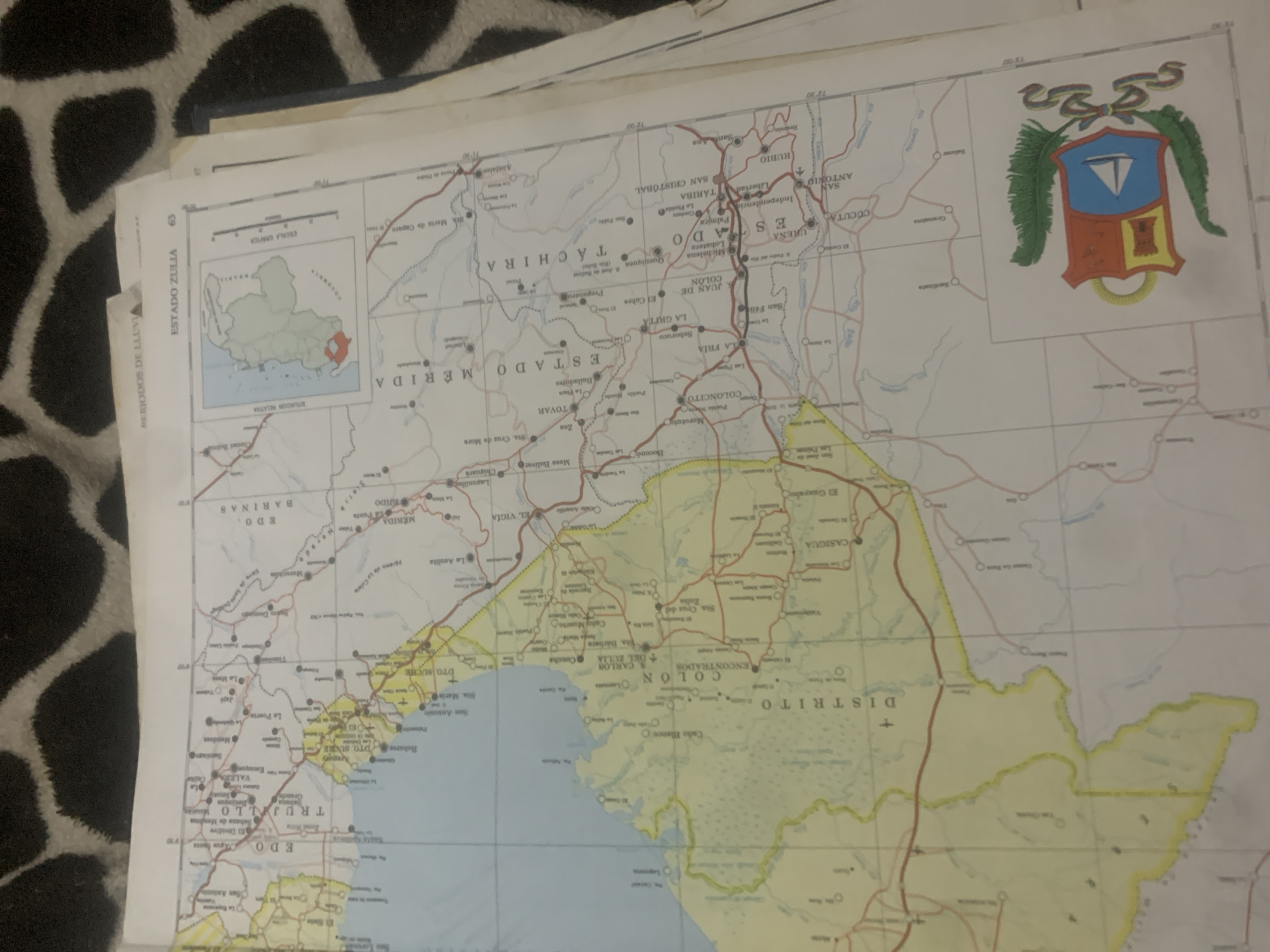
This media file is a photograph of a map, likely a road map or administrative map of Venezuela. The map is laid out flat, partially obscuring a dark, textured surface beneath it, possibly a blanket or carpet. The map itself is colorful, featuring red lines indicating roads, blue lines for rivers, and yellow shading to denote specific regions.

Prominently displayed are the names of Venezuelan states and districts, including "ESTADO ZULIA", "EDO. BARINAS", "ESTADO MÉRIDA", "TÁCHIRA", "ESTADO", "DISTRITO", and "EDO TRUJILLO". Several cities and towns are labeled, such as "SAN CRISTÓBAL", "JUAN DE COLÓN", "LA GRITA", "EL VIGIA", "MERIDA", and "VALERA". A small inset map shows the location of "ESTADO ZULIA" within Venezuela.

In the upper right corner of the map, a coat of arms is visible, featuring a shield with a boat, a fort, and foliage. The map also includes a graphic scale bar and grid lines with latitude and longitude markings. The overall impression is of a detailed, functional map used for navigation or regional information. There are no people or activities depicted, only the static representation of geographical information. The lighting suggests the photograph was taken indoors, possibly with ambient room light.
bombolico

Jun 25, 2026, 2:24 PM

La Tagua, Venezuela

BLOCKED

Stake attention in this memory

nostalgic
curious
studious
reflective
serene

This media file is a photograph of a map, likely a road map or administrative map of Venezuela. The map is laid out flat, partially obscuring a dark, textured surface beneath it, possibly a blanket or carpet. The map itself is colorful, featuring red lines indicating roads, blue lines for rivers, and yellow shading to denote specific regions. Prominently displayed are the names of Venezuelan states and districts, including "ESTADO ZULIA", "EDO. BARINAS", "ESTADO MÉRIDA", "TÁCHIRA", "ESTADO", "DISTRITO", and "EDO TRUJILLO". Several cities and towns are labeled, such as "SAN CRISTÓBAL", "JUAN DE COLÓN", "LA GRITA", "EL VIGIA", "MERIDA", and "VALERA". A small inset map shows the location of "ESTADO ZULIA" within Venezuela. In the upper right corner of the map, a coat of arms is visible, featuring a shield with a boat, a fort, and foliage. The map also includes a graphic scale bar and grid lines with latitude and longitude markings. The overall impression is of a detailed, functional map used for navigation or regional information. There are no people or activities depicted, only the static representation of geographical information. The lighting suggests the photograph was taken indoors, possibly with ambient room light.

Symbol

07422

Volume

0

Creator

+$0.09

Revenue

+$0.00

TVL

$0.00

1D
1W
1M
All

Loading AttnAds…

transactions
revenues
stakers
Earliest
Latest
Highest stake

1

Katy

Staked 11d ago
Redeemed 4d ago

$6.77 USD

+$0.08 USD

Fee: $0.02 (0.25%)

+1%

2

Rev Bot 🤖💰

Injected revenue 11d ago

Revenue bonus for the last stake.

+$0.18 USD

More from this user

More from La Tagua

bombolico

Jun 25, 2026, 2:24 PM

La Tagua, Venezuela

Licensed under Creative Commons Attribution 4.0 International License. You are free to share and adapt this content with proper attribution.





