Stake attention in this memory
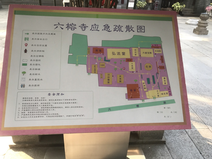
The image displays a large, rectangular informational sign, likely situated outdoors within a temple complex. The sign features a detailed map with a white background and a prominent pink border, set on a stand. The main subject of the sign is a map titled "六榕寺应急疏散图" (Liurong Temple Emergency Evacuation Map). The map illustrates the layout of the temple grounds, depicting various buildings in pink, green areas for greenery and pathways, and yellow for specific zones. Notable structures labeled include 弘法堂 (Hongfa Hall), 大雄宝殿 (Daxiong Baodian - Main Hall), 花园 (Garden), 天王殿 (Hall of Heavenly Kings), 客堂 (Guest Hall), and others. A compass rose indicates cardinal directions: 西 (W), 北 (N), 东 (E), 南 (S). To the left of the map, a legend provides symbols for: evacuation direction and passage, safety exit, current location, fire hydrant, stone steps, fence, green space, sloped path, trees, drinking water, and restrooms. Below the map, a section titled "安全须知" (Safety Notice) lists six rules for visitors and pilgrims. These rules cover reading the evacuation plan, choosing the nearest evacuation route in an emergency, prohibiting fire sources and dangerous goods, abiding by temple rules, forbidding damage to temple property and fire equipment, and reporting incidents by calling "119" or "110". The background shows elements typical of a Chinese temple setting, including blurred traditional architectural features, stone structures, and potted plants. The ground is paved with light-colored tiles. Several blurred figures are visible in the background, suggesting people are present. The lighting indicates it is daytime. The location is confirmed as Liurong Temple in Guangzhou, China.
No transactions found