Sign in
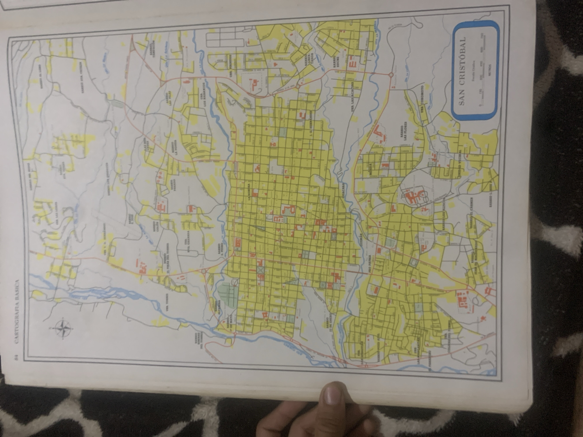
The image shows a map of San Cristóbal, Venezuela, as part of a cartography book. The map is detailed, with streets, neighborhoods, and rivers clearly marked. The neighborhoods are labeled with names like "Barrio Las Flores," "Barrio El Pinar del Torres," and "Pro Patria." Rivers are depicted in blue, winding through the urban landscape. A compass rose is visible in the lower left corner, indicating directions. In the upper right corner, a scale bar is provided, showing distances in meters. The map is in color, with yellow highlighting indicating populated areas and red highlighting indicating specific buildings or landmarks. The page number "84" and the title "CARTOGRAFIA BASICA" are printed on the left side. A hand holding the book is partially visible at the bottom of the frame, suggesting the map is being presented or viewed. The background shows a dark, textured surface, likely a tablecloth or rug. The overall scene is that of a cartographic document being examined, providing geographical information about San Cristóbal.
bombolico

Jun 25, 2026, 2:30 PM

La Tagua, Venezuela

Stake attention in this memory

nostalgic
analytical
curious
detached
contemplative

The image shows a map of San Cristóbal, Venezuela, as part of a cartography book. The map is detailed, with streets, neighborhoods, and rivers clearly marked. The neighborhoods are labeled with names like "Barrio Las Flores," "Barrio El Pinar del Torres," and "Pro Patria." Rivers are depicted in blue, winding through the urban landscape. A compass rose is visible in the lower left corner, indicating directions. In the upper right corner, a scale bar is provided, showing distances in meters. The map is in color, with yellow highlighting indicating populated areas and red highlighting indicating specific buildings or landmarks. The page number "84" and the title "CARTOGRAFIA BASICA" are printed on the left side. A hand holding the book is partially visible at the bottom of the frame, suggesting the map is being presented or viewed. The background shows a dark, textured surface, likely a tablecloth or rug. The overall scene is that of a cartographic document being examined, providing geographical information about San Cristóbal.

Loading AttnAds…

transactions
revenues
stakers
Earliest
Latest
Highest stake

No transactions found

More from this user

More from La Tagua

bombolico

Jun 25, 2026, 2:30 PM

La Tagua, Venezuela

Licensed under Creative Commons Attribution 4.0 International License. You are free to share and adapt this content with proper attribution.



