Stake attention in this memory
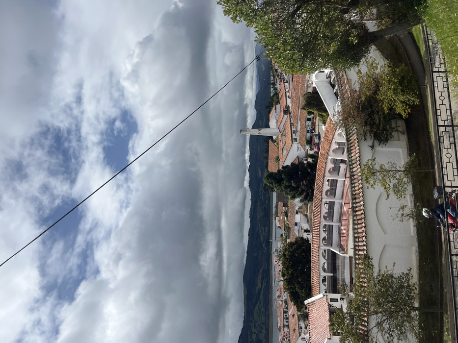
An elevated view captures the town of Guatavita, located within or visible from Vereda Montecillo, Colombia. The sky is partially overcast with large grey clouds dominating, while patches of blue are visible in the upper-left. A thin, dark cable or power line extends diagonally from the upper-left to the lower-right of the frame. In the immediate foreground, a single individual operates a red motorcycle moving from left to right on a paved road. The person wears a white helmet and a blue jacket. The motorcycle is equipped with a black cargo box on its rear. A black metal railing with a decorative pattern separates the elevated vantage point from the road below. To the right of the railing, a green grassy slope features several small trees. The midground is dominated by an urban settlement composed primarily of white buildings with distinctive terracotta tile roofs. A prominent, curved white structure with multiple arched openings, resembling a bullring or arena, is centrally located within the town. Beyond the town's buildings, a large, calm body of water, consistent with the Embalse de Tominé, stretches across the background. This water body is bordered by dark green, forested mountains forming the distant horizon. A tall, slender white cylindrical structure, possibly a chimney or water tower, rises above the rooftops on the right side of the town.
No transactions found