
Stake attention in this memory
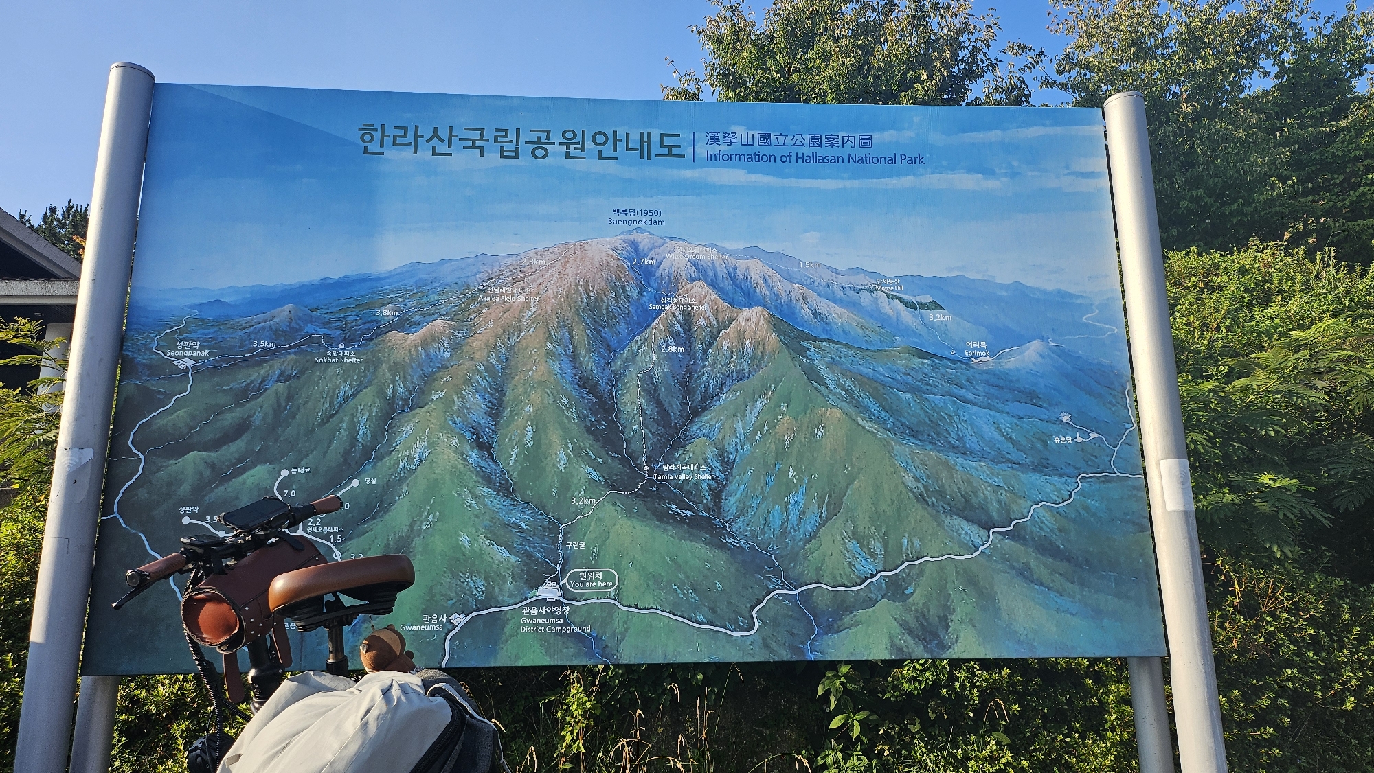
A wide, panoramic map of Hallasan National Park is displayed on a large signpost with two silver poles. The map depicts a stylized aerial view of the volcanic mountain, highlighting trails, shelters, and geological features in various shades of green and blue. Text in Korean and English identifies locations such as "Baengnokdam (1950) peak", "Sokbat Shelter", "Tamla valley Shelter", and "Gwaneumsa District Campground". The sign is positioned outdoors, with a bright blue sky visible at the top and lush green trees and bushes surrounding it. In the foreground, a portion of a bicycle with a brown leather seat and handlebar bag is visible, leaning against the signpost. The overall scene is an outdoor informational display in a natural environment, likely a park or trailhead. The city of Jeju, South Korea is implied as the location due to the presence of "Hallasan National Park", which is located on Jeju Island.
Symbol
0C2FA
Volume
1,898
Creator
+$0.01
Revenue
+$0.00
TVL
$0.28
Loading AttnAds…