
Sign in
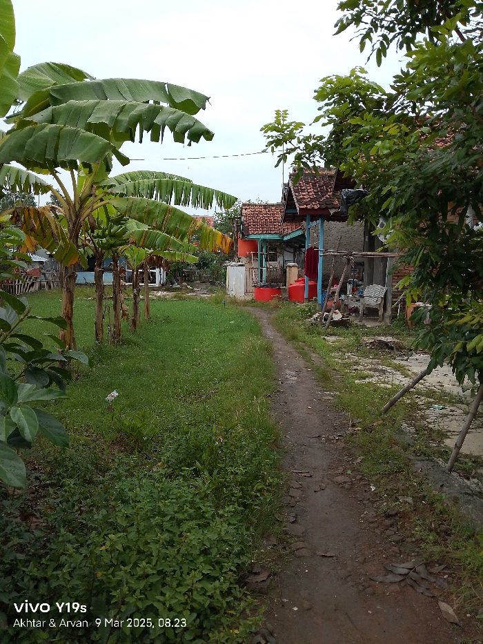
The image shows a dirt path leading past several residential buildings in Anjatan, Indonesia, located at latitude: -6.416, longitude: 107.969.  The path is flanked on the left by a row of banana trees and lush green foliage.  On the right are the sides of multiple buildings with a partially obscured red, and a blue and white building in the background. There are signs of the building having been used as the  clothesline is full of hanging garments. The path appears to be worn and uneven, with patches of grass and debris scattered along its surface. There are no people present.
FM-bXIMf1

Mar 9, 2025, 1:23 AM

Anjatan, Indonesia

Stake attention in this memory

Tranquil
Rural
Serene
Simple
Peaceful

The image shows a dirt path leading past several residential buildings in Anjatan, Indonesia, located at latitude: -6.416, longitude: 107.969. The path is flanked on the left by a row of banana trees and lush green foliage. On the right are the sides of multiple buildings with a partially obscured red, and a blue and white building in the background. There are signs of the building having been used as the clothesline is full of hanging garments. The path appears to be worn and uneven, with patches of grass and debris scattered along its surface. There are no people present.

Loading AttnAds…

transactions
revenues
stakers
Earliest
Latest
Highest stake

No transactions found
More from this user

More from Anjatan

FM-bXIMf1

Mar 9, 2025, 1:23 AM

Anjatan, Indonesia

Licensed under Creative Commons Attribution 4.0 International License. You are free to share and adapt this content with proper attribution.