Stake attention in this memory
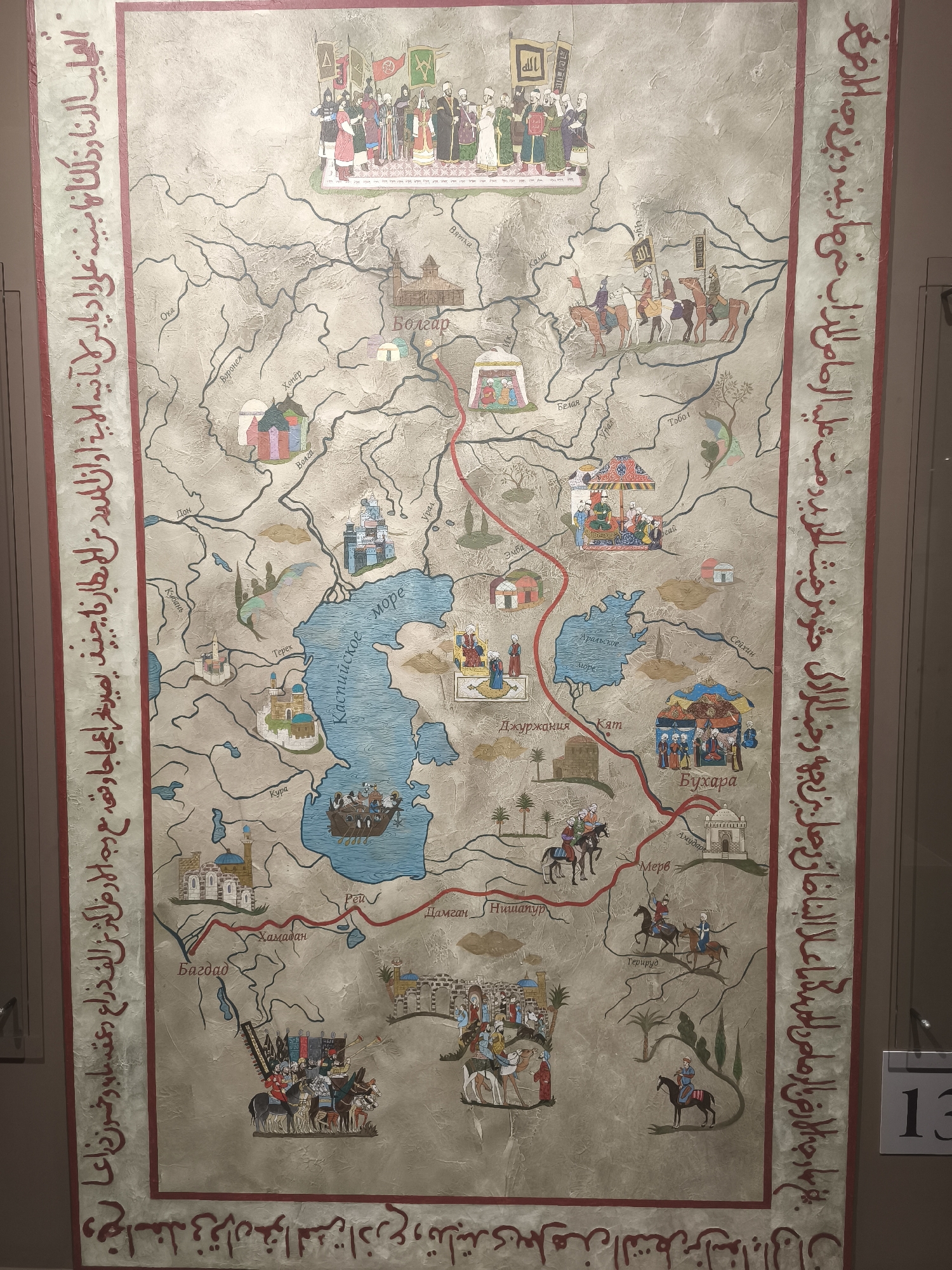
The image is a detailed, hand-drawn map, likely a historical artifact, depicting a region with numerous settlements, waterways, and routes. The map is rendered in a muted palette of earth tones, with vibrant accents for illustrations. Along the left and right edges are columns of Arabic script, suggesting the map's origin or purpose. The map features a large central body of water, labeled "Море" (Sea) and "Каспийское" (Caspian). Various rivers, including the "Дон" (Don), "Урал" (Ural), "Эмба" (Emba), "Терек" (Terek), and "Кура" (Kura), flow into or out of this sea. Numerous towns and cities are marked with illustrations of buildings, tents, and groups of people engaged in various activities. Notable locations include "Болгар" (Bolgar), shown with a large wooden fortress-like structure and tents, "Бухара" (Bukhara) depicted with a mosque and a gathering of people, and "Джурджания" (Gurganj) with a mosque. The map is populated with small, colorful illustrations of people in traditional attire, horses, camels, tents, boats, and architectural structures, adding a narrative and illustrative quality to the geographical data. Figures are shown traveling on horseback, in caravans, and on a rowing boat. A prominent illustration at the top depicts a group of figures, possibly royalty or important dignitaries, gathered under banners. The illustration of Bolgar specifically shows a settlement with fortifications and temporary structures, implying it was a significant location, possibly a trading post or a military stronghold. The presence of multiple routes connecting various points suggests a focus on travel and commerce. The overall presentation is that of an informative and artistic representation of a historical landscape.
No transactions found