Sign in
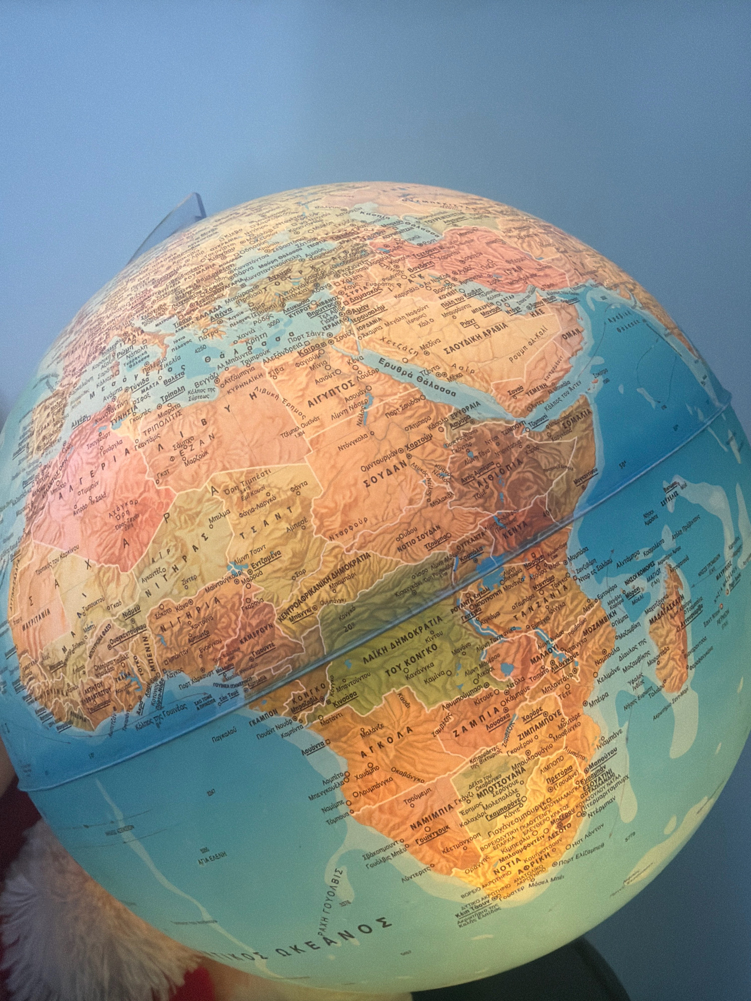
The image is a close-up, eye-level photograph of a globe displaying a map of Africa and the Middle East. The globe is positioned on a surface that is partially visible at the bottom of the frame and appears to be covered with a fuzzy, red material, possibly a blanket or clothing. The background is a solid, muted blue, suggesting a plain wall or backdrop. The lighting is soft and even, highlighting the details on the globe's surface.

The map on the globe is detailed, with country borders, city names, rivers, and mountains clearly marked in Greek. Prominent locations visible include:

*   **ΕΛΛΑΔΑ (Greece)**, with cities like ΑΘΗΝΑ (Athens) and ΠΑΤΡΑ (Patras).
*   The **ΑΙΓΥΠΤΟΣ (Egypt)** region, showing CAIRO and the NILE RIVER.
*   The **ΣΟΥΔΑΝ (Sudan)** region.
*   The **ΣΑΟΥΔΙΚΗ ΑΡΑΒΙΑ (Saudi Arabia)**.
*   The **ΥΕΜΕΝΗ (Yemen)**.
*   The **ΑΙΘΙΟΠΙΑ (Ethiopia)** region.
*   **ΚΕΝΥΑ (Kenya)**.
*   **ΤΑΣΜΑΝΙΑ (Tanzania)**.
*   **ΖΑΜΒΙΑ (Zambia)**.
*   **ΖΙΜΠΑΜΠΟΥΕ (Zimbabwe)**.
*   **ΝΟΤΙΑ ΑΦΡΙΚΗ (South Africa)**.
*   **ΜΟΖΑΜΒΙΚΗ (Mozambique)**.

The city of Χαλάνδρι (Halandri) is a municipality in the northeastern part of the Athens metropolitan area, in the Attica region of Greece. While its exact location is not explicitly marked on this globe with a unique identifier, the general area of Greece is clearly depicted. Given the scale and detail of the globe's map, it is unlikely to pinpoint such a specific suburb.

There are no people visible in the image. The focus is solely on the globe and its cartographic representation of the Earth. The image appears to be a static shot, with no discernible action taking place.
Glamorous

Sep 2, 2026, 9:37 AM

Χαλάνδρι, Greece

Moment

Stake attention in this memory

curiosity
discovery
education
adventure
exploration

The image is a close-up, eye-level photograph of a globe displaying a map of Africa and the Middle East. The globe is positioned on a surface that is partially visible at the bottom of the frame and appears to be covered with a fuzzy, red material, possibly a blanket or clothing. The background is a solid, muted blue, suggesting a plain wall or backdrop. The lighting is soft and even, highlighting the details on the globe's surface. The map on the globe is detailed, with country borders, city names, rivers, and mountains clearly marked in Greek. Prominent locations visible include: * **ΕΛΛΑΔΑ (Greece)**, with cities like ΑΘΗΝΑ (Athens) and ΠΑΤΡΑ (Patras). * The **ΑΙΓΥΠΤΟΣ (Egypt)** region, showing CAIRO and the NILE RIVER. * The **ΣΟΥΔΑΝ (Sudan)** region. * The **ΣΑΟΥΔΙΚΗ ΑΡΑΒΙΑ (Saudi Arabia)**. * The **ΥΕΜΕΝΗ (Yemen)**. * The **ΑΙΘΙΟΠΙΑ (Ethiopia)** region. * **ΚΕΝΥΑ (Kenya)**. * **ΤΑΣΜΑΝΙΑ (Tanzania)**. * **ΖΑΜΒΙΑ (Zambia)**. * **ΖΙΜΠΑΜΠΟΥΕ (Zimbabwe)**. * **ΝΟΤΙΑ ΑΦΡΙΚΗ (South Africa)**. * **ΜΟΖΑΜΒΙΚΗ (Mozambique)**. The city of Χαλάνδρι (Halandri) is a municipality in the northeastern part of the Athens metropolitan area, in the Attica region of Greece. While its exact location is not explicitly marked on this globe with a unique identifier, the general area of Greece is clearly depicted. Given the scale and detail of the globe's map, it is unlikely to pinpoint such a specific suburb. There are no people visible in the image. The focus is solely on the globe and its cartographic representation of the Earth. The image appears to be a static shot, with no discernible action taking place.

Symbol

0F631

Volume

0

Creator

+$0.03

Revenue

+$0.00

TVL

$0.00

1D
1W
1M
All

Loading AttnAds…

transactions
revenues
stakers
Earliest
Latest
Highest stake

1

Shubham

Staked 3d ago
Redeemed 9h ago

$2.33 USD

+$0.00 USD

Fee: $0.01 (0.25%)

+0.2%

2

Rev Bot 🤖💰

Injected revenue 3d ago

Revenue bonus for the last stake.

+$0.04 USD

More from this user

More from Χαλάνδρι

Glamorous

Sep 2, 2026, 9:37 AM

Χαλάνδρι, Greece

Licensed under Creative Commons Attribution 4.0 International License. You are free to share and adapt this content with proper attribution.