
Stake attention in this memory
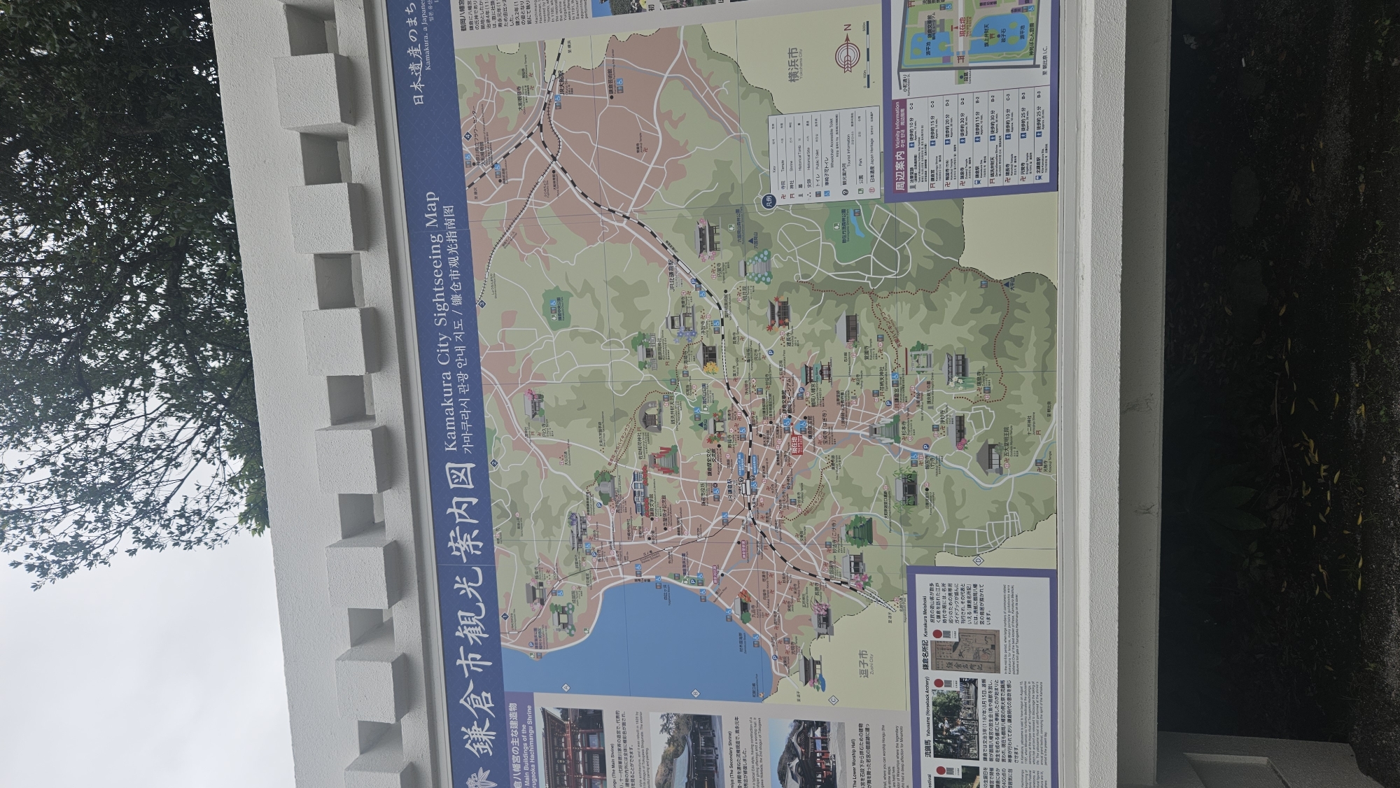
This is a photograph of a large, detailed map titled "Kamakura City Sightseeing Map". The map is mounted on a white, textured wall with a crenellated top edge, suggesting it is outdoors. The map itself is colorful and displays various landmarks, roads, and geographical features of Kamakura, Japan. Text is present in Japanese, English, and possibly Korean. Key elements visible on the map include: * **Kamakura's coast and bay:** The western edge of the map shows the coastline and what appears to be the bay. * **Urban areas and transportation:** Numerous streets, train lines (marked with "JR"), and train stations are depicted. * **Temples and shrines:** A multitude of religious sites are marked with icons, such as a torii gate symbol and a temple roof symbol. Several specific temple names are visible, including "鶴岡八幡宮" (Tsurugaoka Hachimangu Shrine), "長谷寺" (Hasedera Temple), and "建長寺" (Kenchoji Temple). * **Parks and other points of interest:** Green areas representing parks, museums (like the "鎌倉国宝館" - Kamakura National Treasure House), and other tourist attractions are marked. * **Information panels:** Sections on the left and right sides of the map provide additional information. The left panel details "鶴岡八幡宮の主な建造物" (Main Buildings of Tsurugaoka Hachimangu Shrine) with images and descriptions. The right panel, labeled "周辺案内" (Surrounding Information) and "Visibility Information", contains a table with locations, distances, and estimated walking times to various sites, along with a scale bar indicating 500 meters. * **Directional indicators:** A compass rose on the right side of the map shows "N" for North. The surrounding environment visible in the photograph includes a large tree with green foliage and branches overhanging the top of the map and the white wall. The lighting suggests an overcast day. The photograph is taken from a slightly low angle, looking up at the map.
Loading AttnAds…
No transactions found