Stake attention in this memory
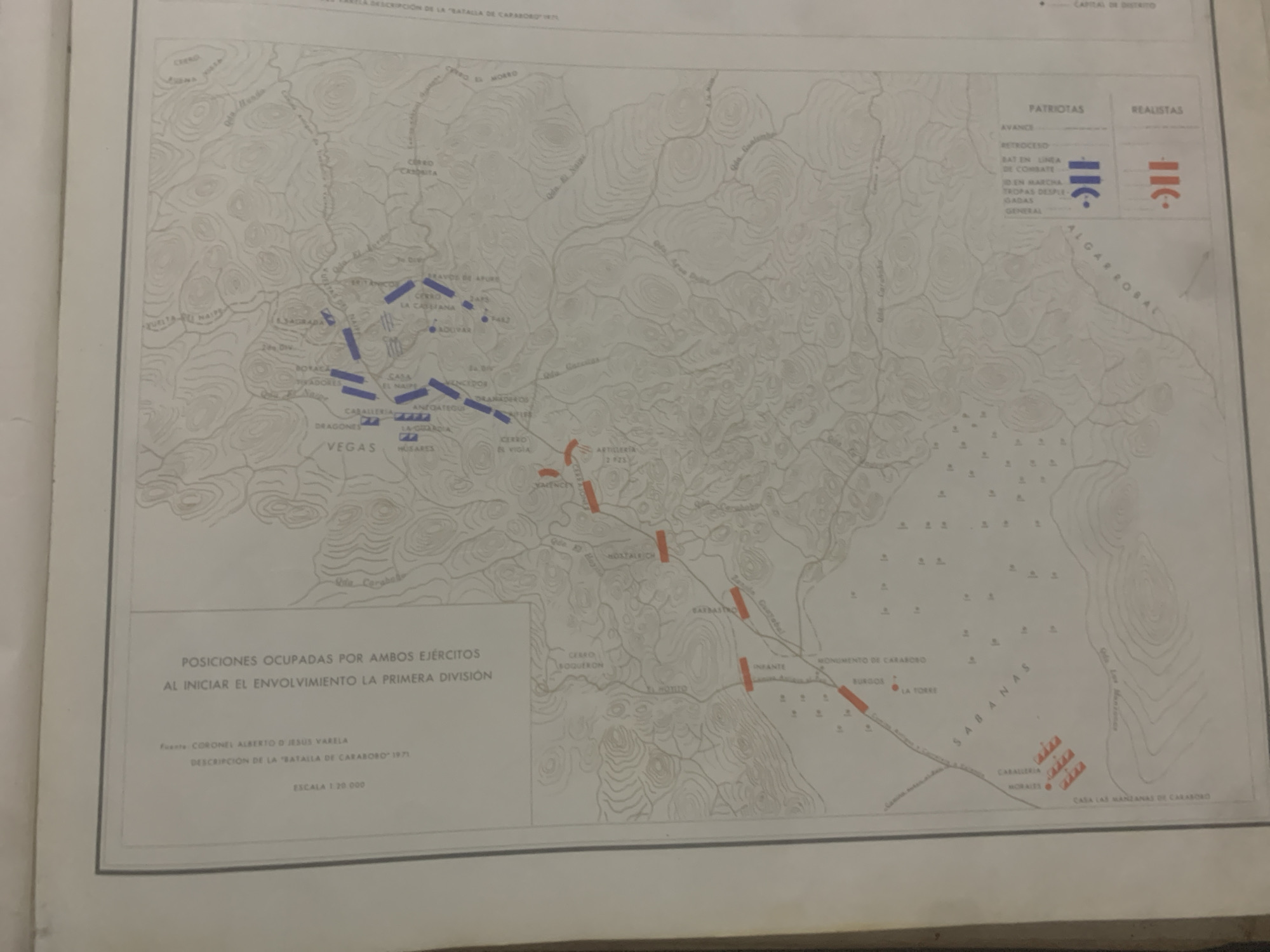
This is a scanned image of a historical map depicting troop positions during the Battle of Carabobo. The map is predominantly in shades of gray and white, with blue and red markings to represent the opposing armies. The map illustrates a topographical landscape with contour lines indicating hills and valleys, and lines representing rivers and roads. Various locations are labeled in Spanish, including "Cerro El Morro," "La Sabanita," "Vega," and "Sábanas." Military units are indicated by symbols and labeled, such as "Caballería," "Dragones," "Tiradores," "Infante," and "Artillería." The legend in the upper right corner shows symbols for "Patriotas" (Patriots) and "Realistas" (Royalists), with different symbols for "Avance," "Retroceso," "Bat en Línea de Combate," "Id en Marcha," and "Tropas Desplegadas." The main title at the bottom states "POSICIONES OCUPADAS POR AMBOS EJÉRCITOS AL INICIAR EL ENVOLVIMIENTO LA PRIMERA DIVISIÓN," which translates to "Positions Occupied by Both Armies at the Start of the Envelopment of the First Division." The source is attributed to "CORONEL ALBERTO D JESUS VARELA" and the description is from "DESCRIPCIÓN DE LA BATALLA DE CARABOBO 1971." The scale is given as "ESCALA 1:20.000." The image captures a detailed military plan or historical record of a battle. The map itself is the primary subject, with the terrain, troop movements, and key locations being the focus. There are no people or objects depicted beyond the symbolic representations of military forces. The setting is clearly a battlefield in Venezuela, likely around the Carabobo region, given the title. The map appears to be old, possibly from the late 20th century based on the date in the description.
Symbol
1096D
Volume
11,550
Creator
+$0.14
Revenue
+$0.22
TVL
$11.64
2
Rev Bot 🤖💰
Injected revenue 6d ago
“Revenue bonus for the last stake.”
+$0.24 USD


