
Stake attention in this memory
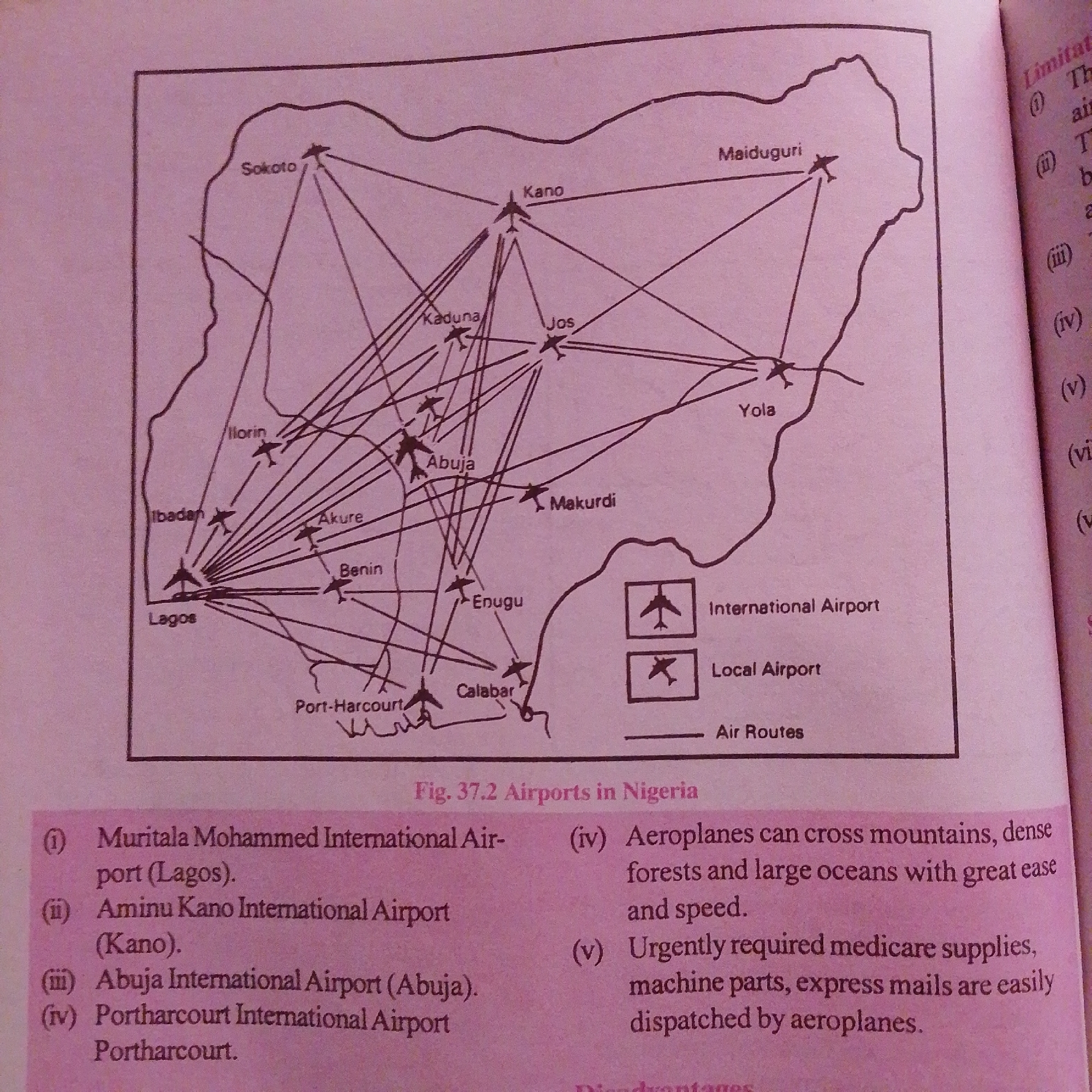
This media file is a scan of a page from a book, likely an educational text, featuring a diagram of airports and air routes in Nigeria, labeled "Fig. 37.2 Airports in Nigeria." The diagram depicts a map of Nigeria with various cities marked, including Sokoto, Kano, Maiduguri, Yola, Abuja, Makurdi, Kaduna, Jos, Ilorin, Ibadan, Lagos, Benin, Akure, Enugu, Calabar, and Port-Harcourt. Lines connecting these cities represent air routes. Two legend boxes indicate symbols for "International Airport" and "Local Airport," with a symbol for "Air Routes." Below the map, there is a numbered list identifying four major airports: Muritala Mohammed International Airport (Lagos), Aminu Kano International Airport (Kano), Abuja International Airport (Abuja), and Portharcourt International Airport (Portharcourt). To the right of the numbered list, there are points (iv) and (v) detailing the advantages of air travel, specifically mentioning the ability of aeroplanes to traverse difficult terrain and oceans, and their efficiency in transporting urgent medical supplies, machine parts, and express mail. The text on the right side of the page is partially visible and appears to be a continuation of the topic, with labels like "Limitatio" and numbered points (i) through (vi). The overall context suggests the topic is about transportation, specifically air travel in Nigeria, and its benefits. The image is likely taken indoors, possibly in a classroom or study environment, with a focus on the educational material presented. There are no people or animals visible in the image. The lighting is consistent with indoor ambient light.
Symbol
12162
Volume
3,895
Creator
+$0.00
Revenue
+$0.01
TVL
$0.35
Loading AttnAds…

2

Rev Bot 🤖💰
Injected revenue 1mo ago
“Revenue bonus for the last stake.”
+$0.01 USD