Stake attention in this memory
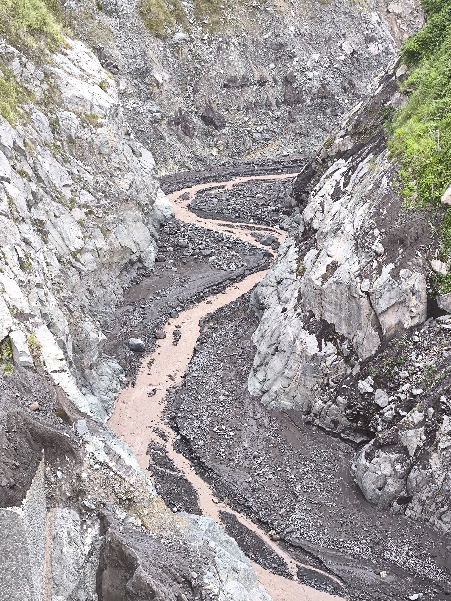
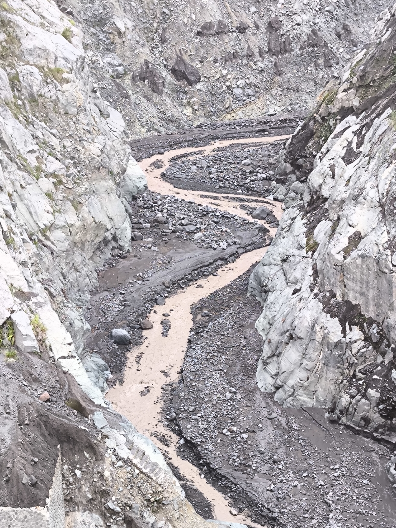
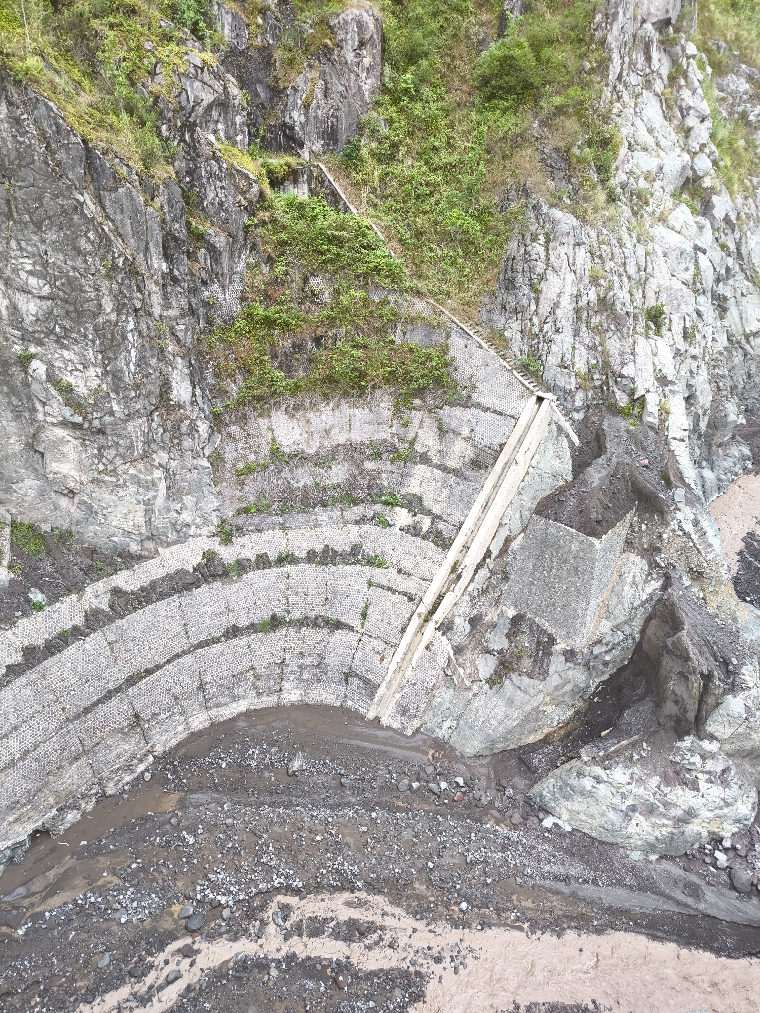
This is an aerial photograph of a terraced rock wall designed to prevent landslides, situated in a natural setting. The scene is dominated by steep, rocky cliffs covered in patches of greenery and vegetation. A series of curved, stepped terraces, constructed with what appears to be gabion walls (wire cages filled with stones), are visible, descending down the side of the cliff face. These terraces are interspersed with dark soil and some smaller rocks, suggesting a watercourse or a drainage system. At the top of the terraces, a concrete structure and a wooden walkway or ramp are present, likely part of the landslide prevention system. The lower part of the image shows a sandy and rocky riverbed, with evidence of flowing water, indicated by the wet sand and distinct channels. The overall impression is one of a rugged, natural landscape that has been engineered to mitigate the risks associated with steep terrain. There is no visible text in the image. The lighting suggests it could be daytime, with diffused light indicating potentially overcast conditions or that the sun is not directly overhead. The location context provided is Supiturang, Indonesia, which aligns with the appearance of a tropical or subtropical mountainous region. The image captures a static scene, focusing on the structural elements and the natural environment.
No transactions found