
Sign in
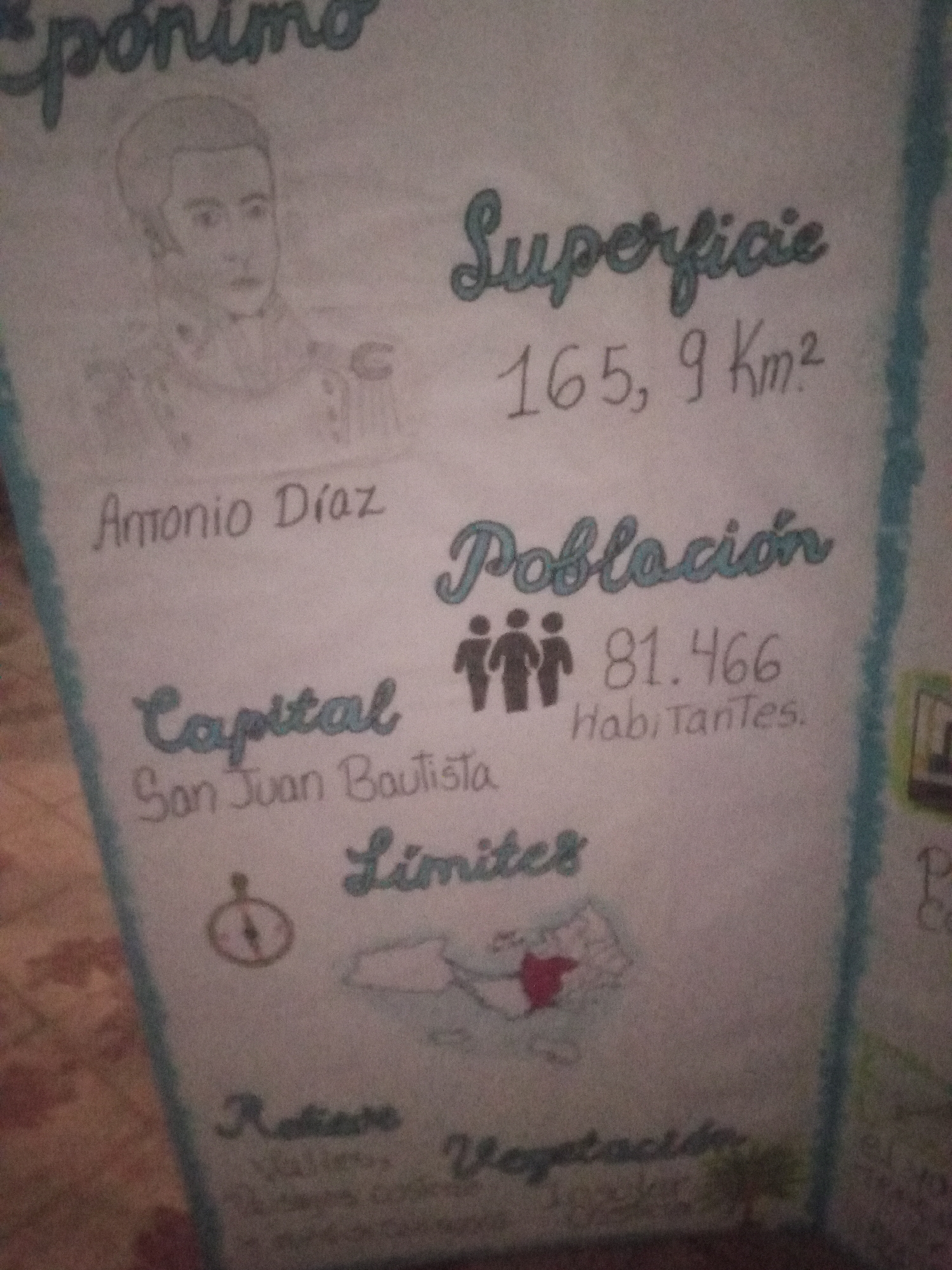
The image is a hand-drawn poster with information about a location. At the top left, there is a sketch of a man's head and shoulders, possibly a historical figure, with the word "epónimo" above it. To the right, "Superficie" is written, followed by "165, 9 Km²". Below the sketch of the man is the name "Antonio Díaz". Further down, "Capital" is written, with "San Juan Bautista" beneath it. Next to "Capital" is an icon of a compass. To the right of the compass and below "Superficie" is the word "Población", with three stick figures representing people, and the number "81.466 Habitantes". Below that, the word "Límites" is written, and a simple outline map of a territory is shown, with a red colored area within it. At the bottom, there are two more sections: "Relieve" (Relief) on the left, with some illegible text underneath, and "Vegetación" (Vegetation) on the right, also with some illegible text. The overall style suggests a school project or informational display about a geographical area. The mention of "San Juan Bautista" as the capital, combined with the historical figure "Antonio Díaz" and the country Venezuela, points to the municipality of Libertador in the state of Sucre, Venezuela, which has San Juan Bautista as its capital and is known for its rich history.
cucha

Jun 23, 2026, 11:08 AM

Santa Ana, Venezuela

Stake attention in this memory

informative
educational
historical
researched
handcrafted

The image is a hand-drawn poster with information about a location. At the top left, there is a sketch of a man's head and shoulders, possibly a historical figure, with the word "epónimo" above it. To the right, "Superficie" is written, followed by "165, 9 Km²". Below the sketch of the man is the name "Antonio Díaz". Further down, "Capital" is written, with "San Juan Bautista" beneath it. Next to "Capital" is an icon of a compass. To the right of the compass and below "Superficie" is the word "Población", with three stick figures representing people, and the number "81.466 Habitantes". Below that, the word "Límites" is written, and a simple outline map of a territory is shown, with a red colored area within it. At the bottom, there are two more sections: "Relieve" (Relief) on the left, with some illegible text underneath, and "Vegetación" (Vegetation) on the right, also with some illegible text. The overall style suggests a school project or informational display about a geographical area. The mention of "San Juan Bautista" as the capital, combined with the historical figure "Antonio Díaz" and the country Venezuela, points to the municipality of Libertador in the state of Sucre, Venezuela, which has San Juan Bautista as its capital and is known for its rich history.

Loading AttnAds…

transactions
revenues
stakers
Earliest
Latest
Highest stake

No transactions found

More from this user

More from Santa Ana

cucha

Jun 23, 2026, 11:08 AM

Santa Ana, Venezuela

Licensed under Creative Commons Attribution 4.0 International License. You are free to share and adapt this content with proper attribution.