Stake attention in this memory
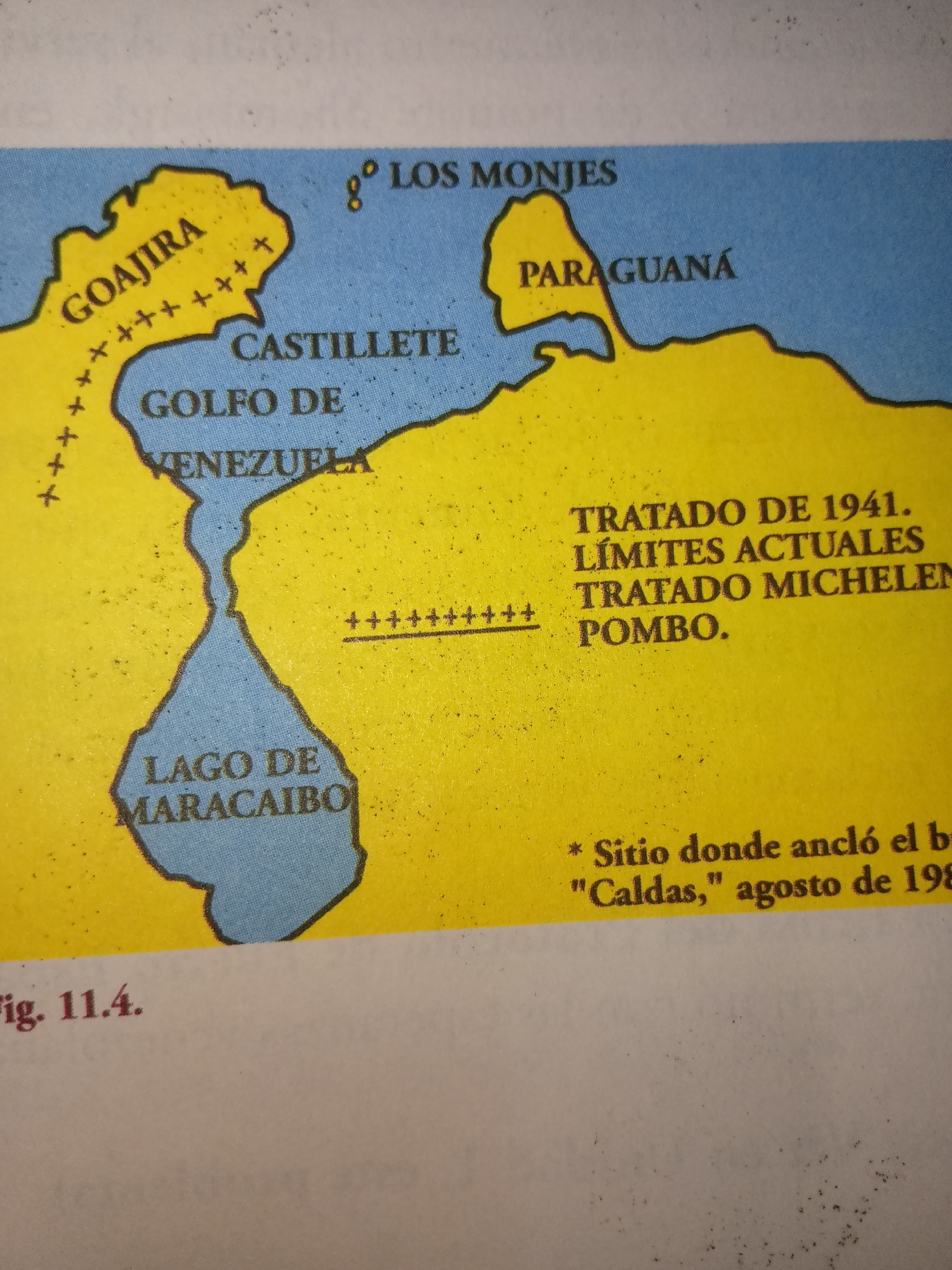
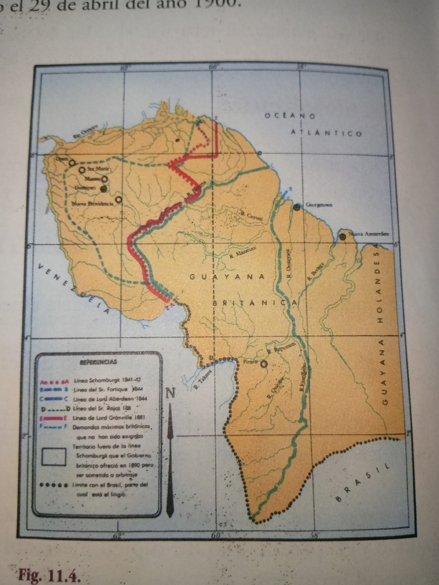
The image is a historical map of the Guianas region in South America, showing political boundaries and rivers. The map is titled "Fig. 11.4." and is dated "29 de abril del año 1900". The geographical area covered includes parts of Venezuela, British Guiana (now Guyana), and Dutch Guiana (now Suriname), as well as a border with Brazil. Several cities and rivers are labeled, including "R. Orinoco", "Caracas", "Georgetown", and "Nueva Amsterdam". A legend in the bottom left corner explains different types of borders, such as "Línea Schomburgk 1841-42" and "Línea del Sr. Fortique 1844". There are no people or specific actions depicted, as it is a map. The city of Guayacán is not labeled on this map, and Venezuela is indicated with the text "VENEZUELA" along the coast.
No transactions found