Stake attention in this memory
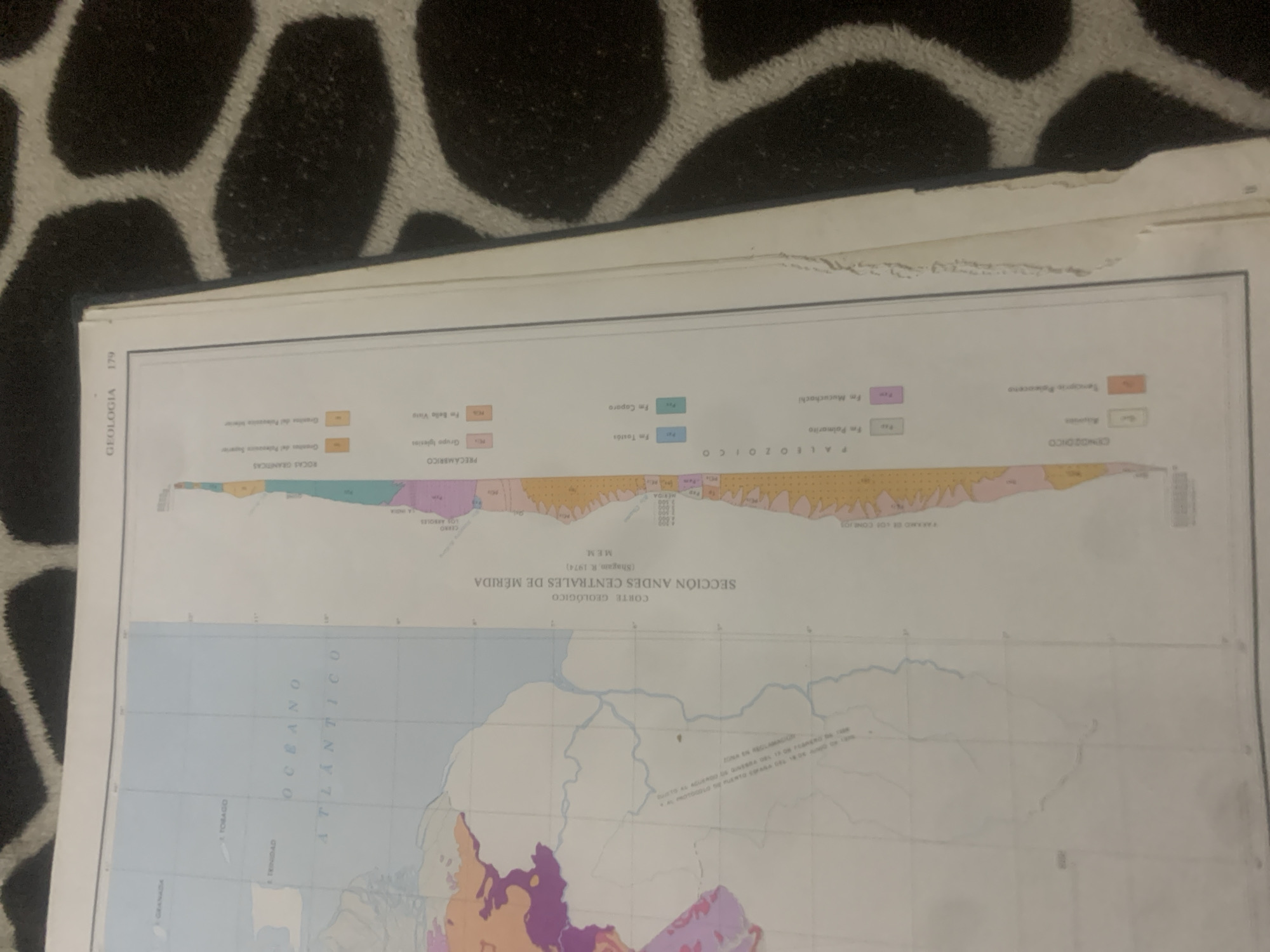
This media file is a photograph of a geological map with a cross-section of the Andes Centrales de Mérida, Venezuela. The map displays various geological formations and rock types, indicated by different colors and labels. Prominent text includes "GEOLOGÍA 179", "SECCIÓN ANDES CENTRALES DE MÉRIDA", "CORTE GEOLÓGICO", and "OCEANO ATLÁNTICO". The cross-section illustrates geological layers with labels such as "PALEOZOICO", "PRECAMBRICO", and specific rock formations like "Fm Mucuchachi" and "Fm Caparo". The map also includes labels for geographical locations like "TRINIDAD" and "TOBAGO". Below the cross-section, a topographical map shows rivers and landmasses. The overall image appears to be a page from a geological publication or textbook, with the page itself exhibiting some wear and tear at the top edge. The background of the photograph is a black and white patterned fabric, possibly a rug or blanket, which is out of focus and serves as the setting for the photograph of the map.
Symbol
17439
Volume
0
Creator
+$0.14
Revenue
+$0.00
TVL
$0.00
2
Rev Bot 🤖💰
Injected revenue 6d ago
“Revenue bonus for the last stake.”
+$0.31 USD