Stake attention in this memory
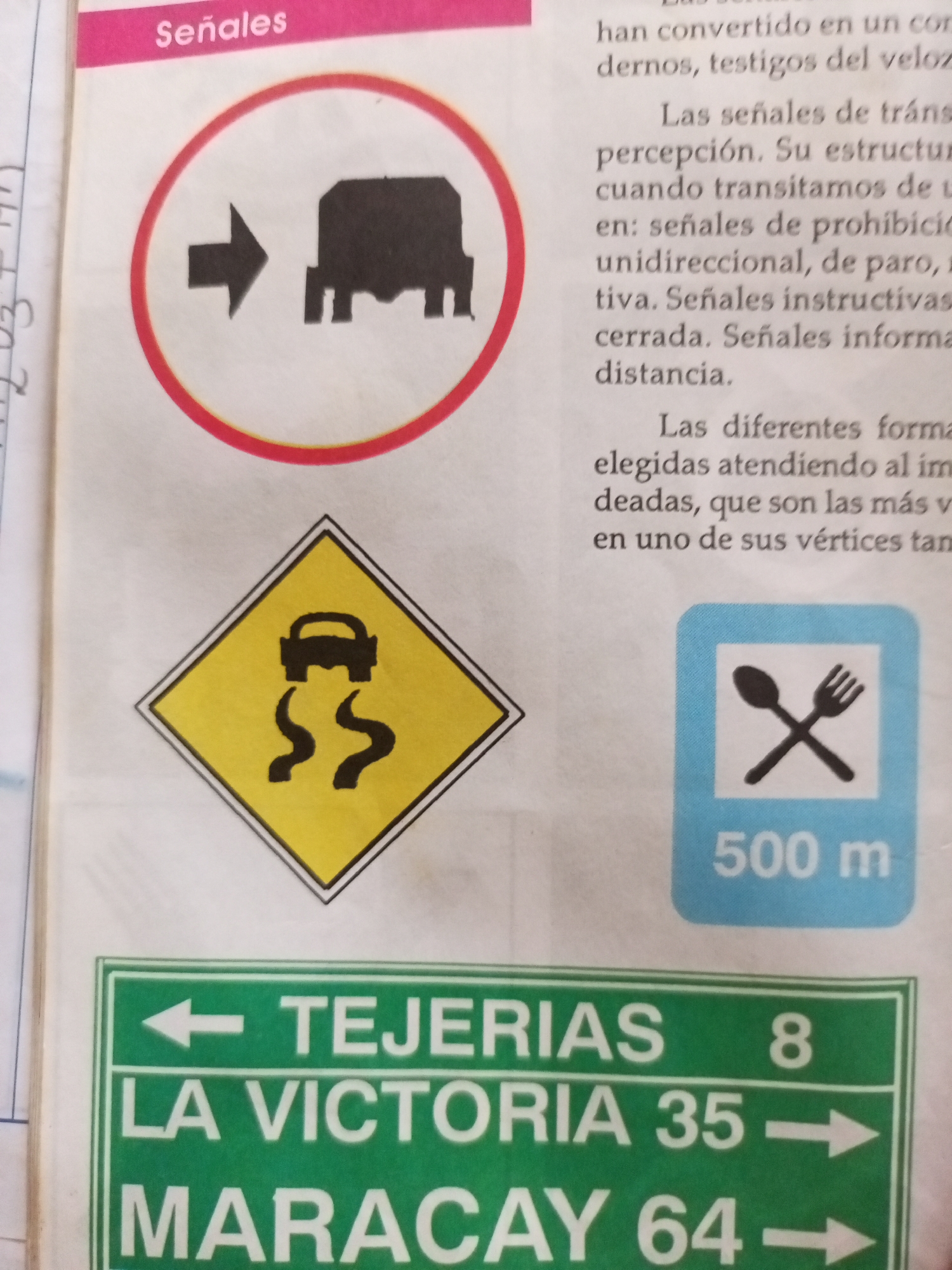
The image displays a page from a book or manual related to road signs. The title "Señales" is visible at the top. Several different types of road signs are depicted. One sign is a circular sign with a red border and a white background. Inside, there is a black arrow pointing to the right, followed by a black silhouette of a truck or bus. This sign likely indicates a restriction or guidance for vehicles of this type. Below this, a yellow diamond-shaped sign with a black border contains a black illustration of a car skidding on a wet or slippery surface, indicated by wavy lines beneath the tires. This is a warning sign for slippery roads. To the right of the slippery road sign is a blue square with rounded corners. Inside the square, on a white background, are black icons of a fork and spoon, and below that, the text "500 m". This sign likely indicates a restaurant or food service is available within 500 meters. At the bottom of the image, a green rectangular sign with white text provides directional information. The text reads "← TEJERIAS 8", "LA VICTORIA 35 →", and "MARACAY 64 →". This sign indicates directions and distances to several locations: Tejeria (with distance 8, though the unit is not specified), La Victoria (35 units away), and Maracay (64 units away). The text on the right side of the page provides explanations about traffic signs, mentioning their purpose in perception, prohibition, instruction, and information. The overall scene is that of an educational or informational resource about road signage. The lighting appears to be consistent, suggesting an indoor setting. There are no people or clear indications of a specific time of day or weather conditions. The location context provided states Santa Ana, Venezuela, which would align with the Spanish text on the signs.
Symbol
176A4
Volume
0
Creator
+$0.10
Revenue
+$0.00
TVL
$0.00
2
Rev Bot 🤖💰
Injected revenue 11d ago
“Revenue bonus for the last stake.”
+$0.23 USD