
Stake attention in this memory
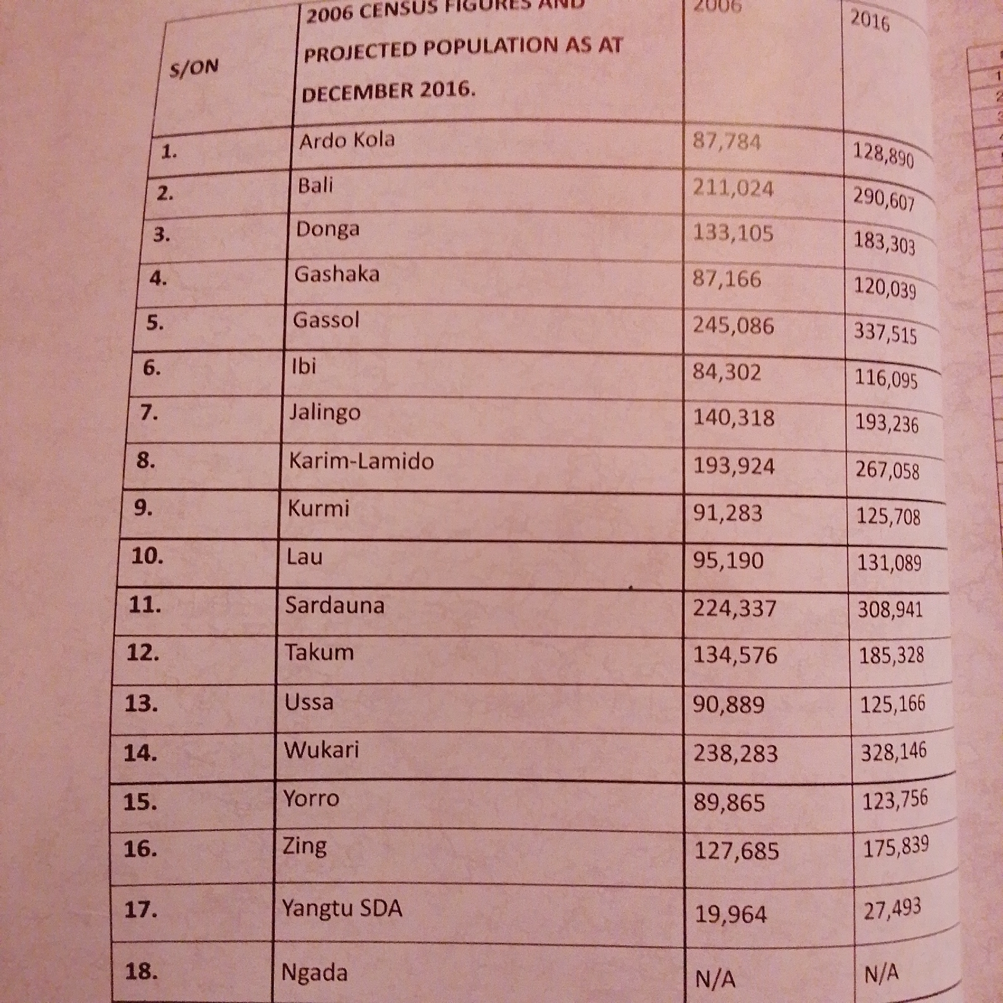
The image is a close-up of a document displaying a table of census figures and projected population data. The table has columns for "S/ON" (Serial Number), "2006 CENSUS FIGURES AND PROJECTED POPULATION AS AT DECEMBER 2016," and two sub-columns for years "2006" and "2016". The rows list various locations, likely administrative areas within Nigeria, with corresponding population numbers for 2006 and 2016. Some of the locations listed are Ardo Kola, Bali, Donga, Gashaka, Gassol, Ibi, Jalingo, Karim-Lamido, Kurmi, Lau, Sardauna, Takum, Ussa, Wukari, Yorro, Zing, Yangtu SDA, and Ngada. The document appears to be an official record or report. There is no visual information in the image that would indicate a specific location in the city of Jalingo, Nigeria, beyond the mention of "Jalingo" as one of the listed areas.
Symbol
183B9
Volume
3,548
Creator
+$0.00
Revenue
+$0.01
TVL
$0.29
Loading AttnAds…

2

Rev Bot 🤖💰
Injected revenue 1mo ago
“Revenue bonus for the last stake.”
+$0.01 USD