
Stake attention in this memory
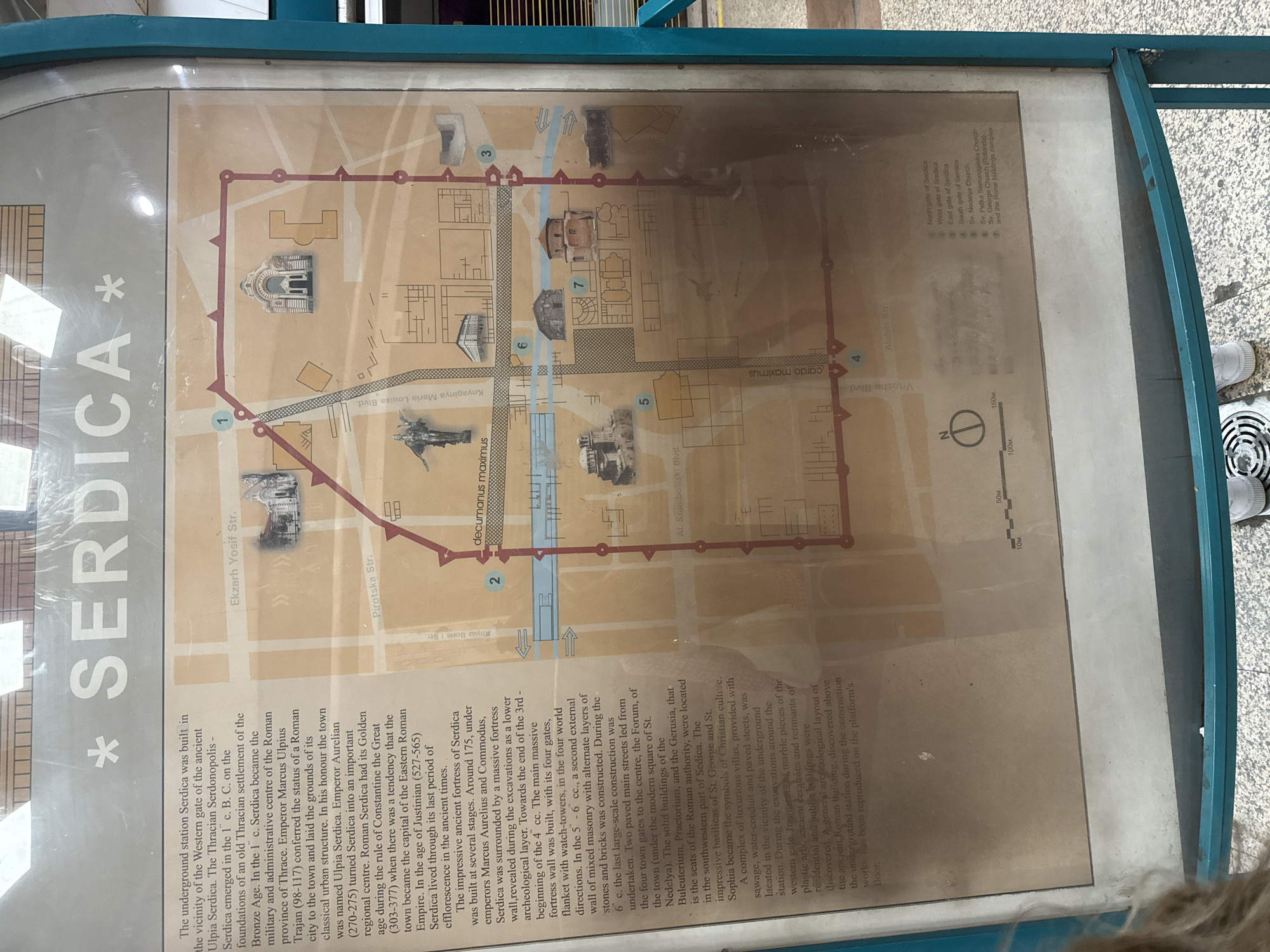
This image shows a map of ancient Serdica (now Sofia, Bulgaria) displayed on a sign near the Serdica underground station. The map outlines the boundaries of the Roman-era city with a red line, marking its gates in the north, west, east, and south (numbered 1-4). Major thoroughfares like "decumanus maximus" and "cardo maximus" are labeled. Key buildings such as the churches of Sveta Nedelya, Sveta Petka Samardjiyska, and Saint George Rotunda are indicated, along with the Roman buildings complex. The map includes a scale, providing dimensions in meters. The text to the left details the history of Serdica, from its Thracian origins through its Roman golden age and subsequent periods.
Loading AttnAds…
No transactions found