Stake attention in this memory
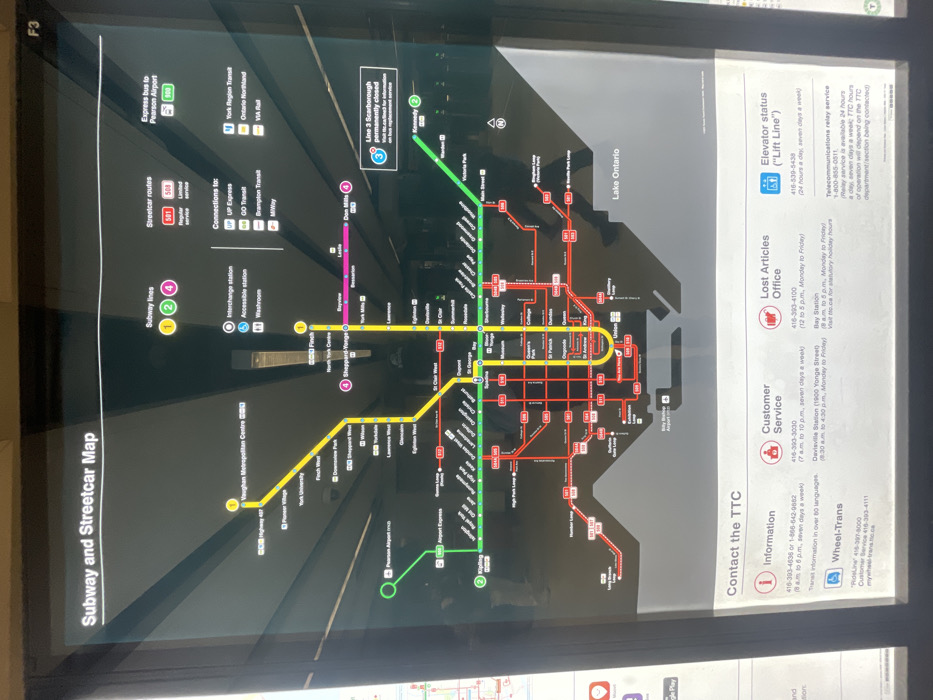
The image shows a map of the Toronto Transit Commission (TTC) subway and streetcar system. The map is located on a sign at a TTC station. The coordinates, 43.646, -79.379, are close to Union Station, which is located at the bottom of the map, near the intersection of Queen Street West and Bay Street. The map shows the different subway lines (1, 2, 3, and 4), and the different streetcar routes. The map also includes information about the location of the interchange station, accessible station, washroom, and other information relevant to transit. The sign also includes information on contact details for TTC Information, Customer Service, Lost Articles Office, and Elevator status. The map is a useful guide for navigating the TTC system.
No transactions found


