Stake attention in this memory
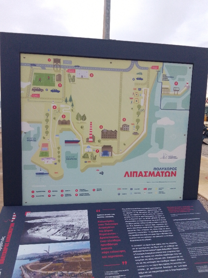
This outdoor informational panel provides details about the "Polyhoros Lipasmaton" (Fertilizer Multipurpose Area) in Drapetsona, Greece. The top portion features a colorful, illustrated map of a coastal complex, indicating various points of interest with numbers and symbols. These include a municipal football field (2), a lighthouse (6), an exhibition center (7), a municipal theater (bottom left), and a pier (9) labeled for "free access and parking." The map also shows roads, parking areas, green spaces, and a body of water with a ferry and smaller boats. A legend at the bottom of the map provides a key to the numbered locations and amenities like restrooms and bicycle paths. The lower part of the panel displays text in Greek alongside two historical or aerial photographs. One image, likely older and black and white, depicts extensive industrial structures along the waterfront. The second, a color aerial shot, shows a transformed coastal area with green spaces and remnants of industrial infrastructure. The Greek text, partially visible, explains that the Polyhoros Lipasmaton in the Municipality of Keratsini-Drapetsona is an "accessible open space for visitation and touring," emphasizing its restoration from an industrial site into a public amenity for citizens. The setting is outdoors under an overcast sky, with the panel mounted on a stand, and the ground appearing to be light-colored gravel or concrete.
No transactions found