
Sign in
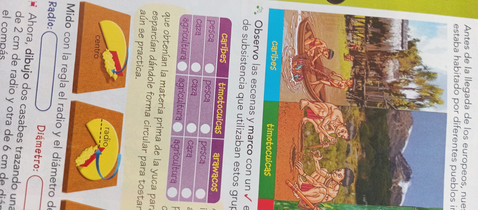
The image displays a page from an educational book, likely for children, with a focus on indigenous cultures and geometry. The left side of the page features illustrations and text related to measuring circles. There's an illustration of a compass creating a circular shape, with labels for "centro" (center) and "radio" (radius). Accompanying text describes how to measure and draw circles of different radii and diameters, mentioning drawing "casabes" (a type of flatbread) and the use of a compass.

The right side of the page presents illustrations of indigenous people and their way of life, likely in pre-Columbian or early colonial times. One image depicts people in a canoe fishing, with a label "caribes" (Caribs). Another scene shows individuals engaged in agriculture or craftwork, with the label "timotocuicas" (Timotocuicas). Further down, there's an illustration of a village or settlement. Text accompanying these images discusses subsistence practices of different indigenous groups, including fishing, hunting, and agriculture, with labels "timotocuicas" and "arawacos" (Arawacos). There's also a mention of "antes de la llegada de los europeos" (before the arrival of the Europeans), suggesting a historical context.

The overall tone of the page is educational, combining practical geometry with cultural and historical information about indigenous peoples of the region, possibly Venezuela given the location context. The scenes are depicted in a somewhat stylized, illustrative manner.
Ramón

Jun 23, 2026, 1:19 PM

La Tagua, Venezuela

Stake attention in this memory

educational
historical
informative
traditional
analytical

The image displays a page from an educational book, likely for children, with a focus on indigenous cultures and geometry. The left side of the page features illustrations and text related to measuring circles. There's an illustration of a compass creating a circular shape, with labels for "centro" (center) and "radio" (radius). Accompanying text describes how to measure and draw circles of different radii and diameters, mentioning drawing "casabes" (a type of flatbread) and the use of a compass. The right side of the page presents illustrations of indigenous people and their way of life, likely in pre-Columbian or early colonial times. One image depicts people in a canoe fishing, with a label "caribes" (Caribs). Another scene shows individuals engaged in agriculture or craftwork, with the label "timotocuicas" (Timotocuicas). Further down, there's an illustration of a village or settlement. Text accompanying these images discusses subsistence practices of different indigenous groups, including fishing, hunting, and agriculture, with labels "timotocuicas" and "arawacos" (Arawacos). There's also a mention of "antes de la llegada de los europeos" (before the arrival of the Europeans), suggesting a historical context. The overall tone of the page is educational, combining practical geometry with cultural and historical information about indigenous peoples of the region, possibly Venezuela given the location context. The scenes are depicted in a somewhat stylized, illustrative manner.

Loading AttnAds…

transactions
revenues
stakers
Earliest
Latest
Highest stake

No transactions found

More from this user

More from La Tagua

Ramón

Jun 23, 2026, 1:19 PM

La Tagua, Venezuela

Licensed under Creative Commons Attribution 4.0 International License. You are free to share and adapt this content with proper attribution.