Stake attention in this memory
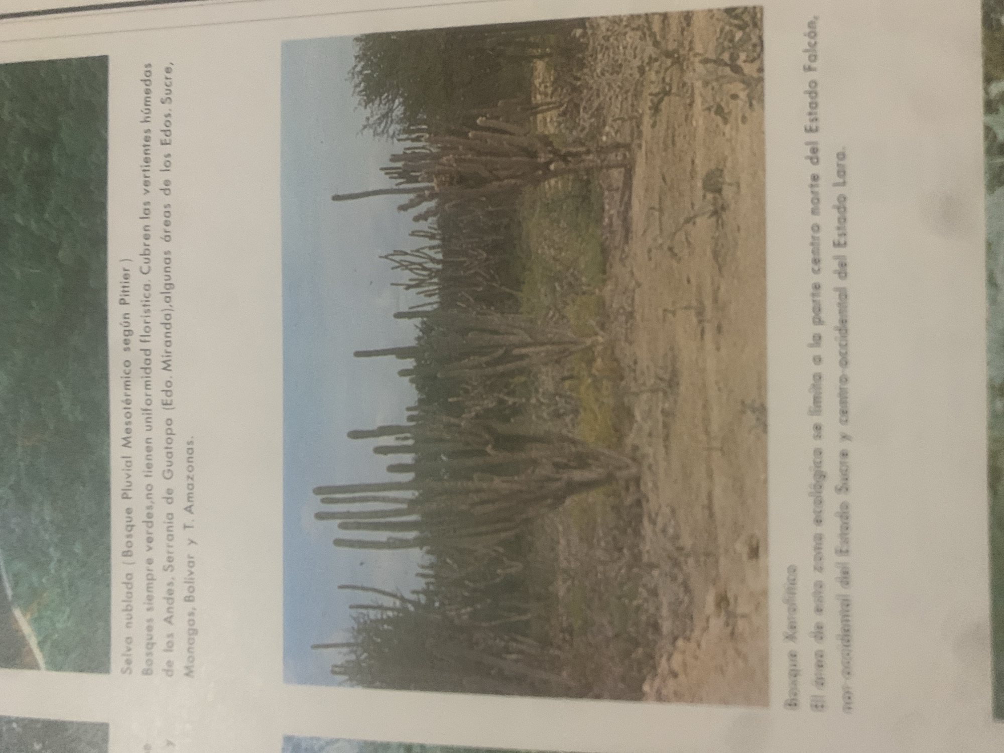
The image is a photograph of a natural landscape, likely in Venezuela, featuring a dense forest on the left and a dry, arid terrain with numerous tall cacti on the right. The photograph is accompanied by Spanish text. The left side of the image shows a lush, green area described as "Selva nublada (Bosque Pluvial Mesotérmico según Pittier)". The text explains that these evergreen forests, which lack uniformity in their flora, cover the humid slopes of the Andes and the Serranía de Guatopo, extending into the states of Sucre, Monagas, Bolívar, and Amazonas. The right side of the image depicts a different ecosystem, characterized by a sandy or dry soil and a prominent collection of tall, columnar cacti. This area is labeled as "Bosque Xerofítico". The accompanying text states that the ecological zone is limited to the central-northern part of Falcón state, the western coast of Sucre state, and west-central Lara state. The lighting suggests it is daytime, with no specific indication of the time. The contrast between the two depicted environments highlights the diverse biomes present in Venezuela. There are no people visible in the photograph, and the focus is entirely on the natural scenery and vegetation.
Symbol
1BEA7
Volume
0
Creator
+$0.11
Revenue
+$0.00
TVL
$0.00
2
Rev Bot 🤖💰
Injected revenue 6d ago
“Revenue bonus for the last stake.”
+$0.23 USD


