Stake attention in this memory
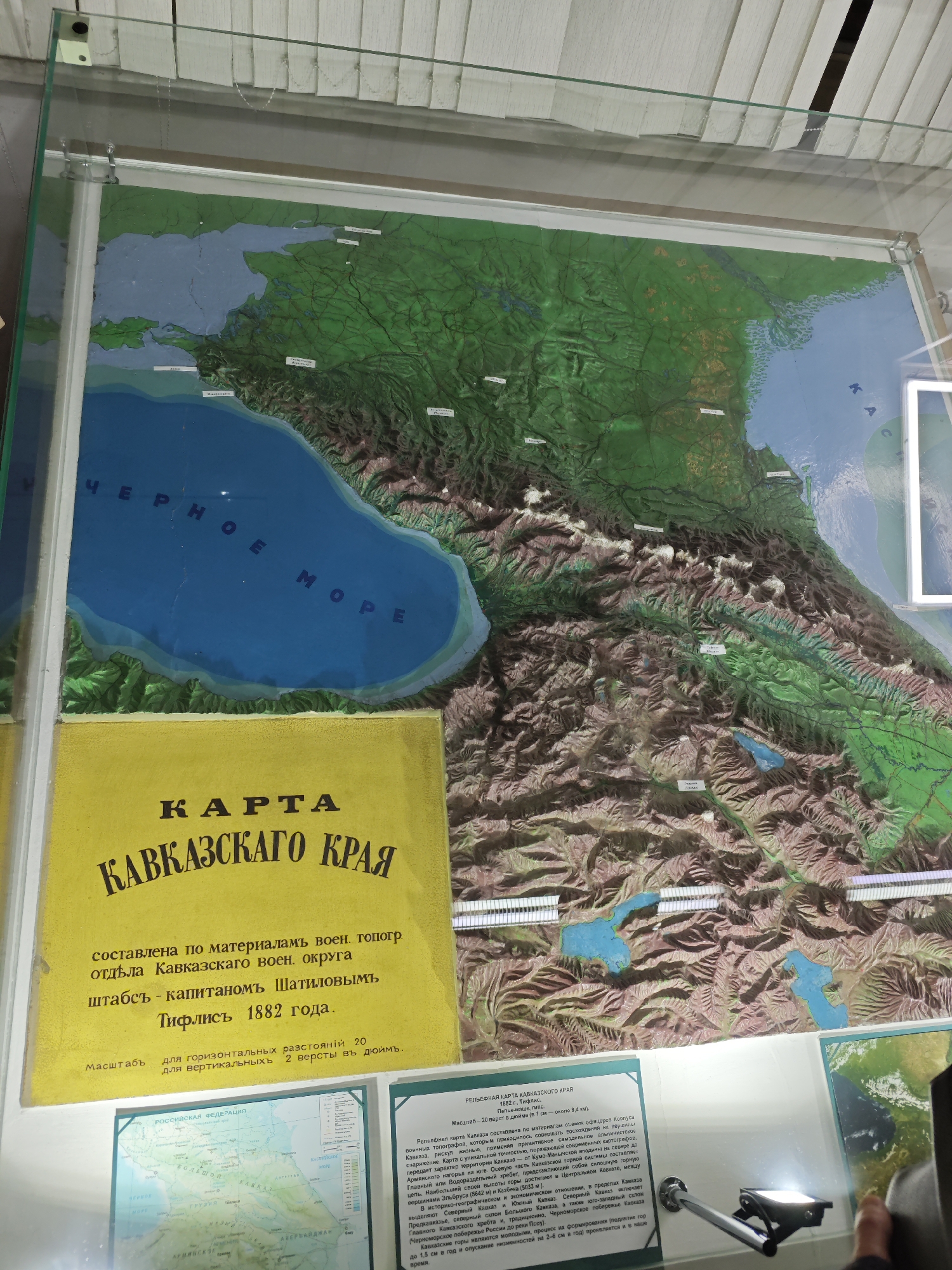
The image shows a display case in a museum in Pyatigorsk, Russia, containing a relief map of the Caucasus region. The map itself is made of papier-mâché and plaster and is painted to depict the terrain. The Black Sea is prominent in the upper left, colored blue, and labeled in Russian. The map also shows various mountains, lakes, and rivers. To the left of the relief map is a yellow plaque with text in Russian, identifying the map as a map of the Caucasus region (Kavkazskogo Kraya) compiled in 1882 by Captain Shatilov. Below the plaque, there are two smaller information plaques, one of which contains a map of Russia. The overall impression is of a historical exhibit showcasing geographical and cartographical information about the Caucasus region.
No transactions found