Stake attention in this memory
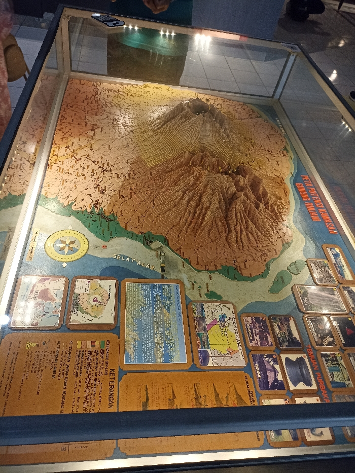
This image captures a detailed 3D topographical model of a mountainous region, prominently featuring a large volcano, displayed within a glass case. The model uses varying shades of brown and tan to represent the rugged terrain and elevation of the mountain, with distinct ridges and valleys. Green areas depict lower elevations or vegetation, and a blue section on the right marks a body of water, labeled "SELAT ALAS" (Alas Strait). A compass rose graphic is visible on the blue water area. Surrounding the 3D model within the display case are numerous information panels, smaller maps, and photographs. These panels provide additional context and details about the depicted area. One prominent text label above the water reads "PETA POTENSI KAWASAN GUNUNG RINJANI," indicating that the model represents Mount Rinjani and its surrounding potential areas. Other visible text includes "KETERANGAN" (Legend/Information), "KETERANGAN GEOLOGI" (Geological Information), "PETA POTENSI KAWASAN RAWAN BENCANA G" (Map of Potential Hazard Zones), "KETERANGAN LAINNYA" (Other Information), and "TEMUAN PURBAKA" (Archaeological Findings). The setting appears to be an indoor exhibition or museum. Reflections of overhead lights and what appear to be visitors, possibly holding cell phones, are visible on the protective glass of the display case. The overall impression is one of an educational exhibit designed to inform visitors about the geography, geology, and potential hazards of Mount Rinjani, located in Mataram, Indonesia.
No transactions found