Stake attention in this memory
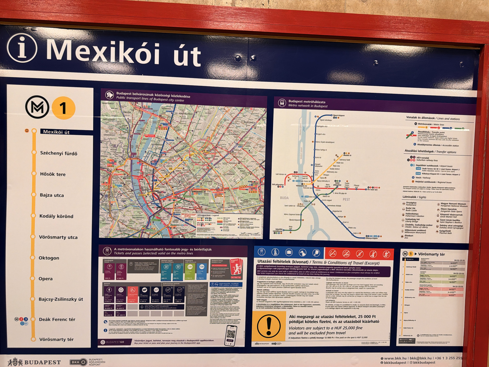
The image is a close-up, eye-level, indoor shot of a public transportation information display board. The board is predominantly dark blue with white text and graphics, framed by a red border. In the upper left, a large white "i" icon is displayed next to the text "Mexikói út" in white sans-serif font. The main part of the board features two large maps: a detailed map of Budapest's public transport network on the left, and a simpler metro network map on the right. Below the metro map is a legend for lines and stations, indicating metro lines, tram lines, HÉV suburban railway lines, and airport buses. Further down, there are sections detailing ticket and pass validity, with prices displayed in Hungarian Forint (Ft). There's also a section titled "Utazási feltételek (kivonat) / Terms & Conditions of Travel (Excerpt)" which outlines rules regarding luggage, animals, and other travel conditions. At the bottom, a QR code and app information are visible, along with the BudapestGO logo and contact information for BKK Budapest. On the left side of the display, a vertical list of metro stations for line M1 is presented, with corresponding service times. The stations listed are: Mexikói út, Széchenyi fürdő, Hősök tere, Bajza utca, Kodály körönd, Vörösmarty utca, Oktogon, Opera, Bajcsy-Zsilinszky út, and Deák Ferenc tér, and Vörösmarty tér. The lighting appears to be artificial, casting a slight glare on the surface of the display. The overall presentation is informative and typical of public transport signage. The location is identified as Budapest based on the text and maps.
No transactions found