Stake attention in this memory
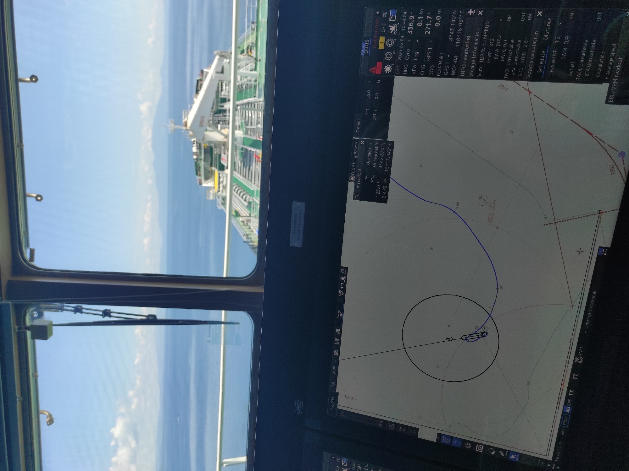
This vertically oriented image captures a view from the bridge of a vessel, looking out to sea on the left and at an Electronic Chart Display and Information System (ECDIS) on the right. Through the ship's window on the left, the clear blue sky and calm blue ocean are visible, with distant land or mountains faintly outlined on the horizon. The foredeck of a large vessel, likely a tanker, with its intricate piping and structures, extends into the frame, suggesting the ship is at sea in bright daylight conditions. Window frames and a windshield wiper are also visible. The right side of the image is dominated by the ECDIS screen, displaying navigation and route information. The brand "JRC" is visible on the display. Key data points indicate the date as 2026-06-04, time as 10:44:04 LMT, and the vessel's position as 4°43.149' N, 118°16.955' E, which places it near Kunak, Malaysia. The Speed Over Ground (SOG) is 0.0 kn, and Speed Through Water (STW) is 0.1 kn, suggesting the vessel is stationary, possibly at anchor or drifting slowly. The screen also shows the ship's heading (HDG Gyro) at 336.9° and Course Over Ground (COG GPS 1) at 271.7°. Route information indicates a journey from "IDBPN to MYKUN" with a destination waypoint (WPT 012). "TWOL Unreachable" and "ETA Unreachable" are displayed, consistent with a stationary vessel. The chart view on the ECDIS shows the vessel's current position, a planned blue route line, and a circular safety zone around the ship, with other targets or vessels indicated. Other visible text on the screen includes "PRIMARY ECDIS," "Current Set 156.9 kn," "DRIFT 0.0 kn," "DISP brightness," "Cursor readout," "TTG: Unreach," "125.6° T," "0.478 NM," "Vector(T) 6 min," "Filter AIS GND TT," "ANT1," and "Information overscale." The map scale is "1:6,000." The clear weather and detailed navigational display suggest routine maritime operations.
Symbol
1F15F
Volume
0
Creator
+$0.00
Revenue
+$0.00
TVL
$0.00