
Stake attention in this memory
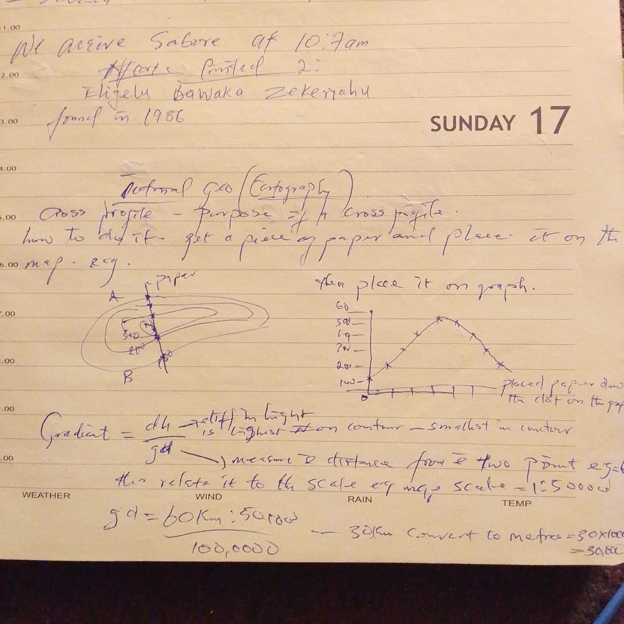
The image is a close-up of a handwritten page from a notebook, likely a diary or a field journal, dating Sunday, the 17th. The writing appears to be in blue ink on lined paper. The content suggests it is related to a geography or surveying task. The first entry notes "We arrive Sabore at 10:7am" with a crossed-out phrase "Africa printed 2". Below this, it mentions "Flilelu Bawaka Zekeriahu" and "Journal in 1986". The subsequent section discusses "National Geo (Cartography)". It details a process for creating a "Cross profile" involving getting a piece of paper and placing it on a graph. A hand-drawn diagram illustrates contour lines on a map, labeled with altitudes like 200 and 300, with a line segment 'A' to 'B' representing the cross-section. A graph is also sketched, showing a parabolic curve with labeled vertical axis values ranging from 0 to 60. A formula for "Gradient" is written as "dh / gd" with annotations indicating "highest" and "smallest in meters". Further notes explain the relationship between the gradient and the map scale, mentioning "this relate it to the scale of map scale = 1:50000". Finally, there's a calculation for conversion: "gd = 60Km : 50,000" which then leads to "100,000" and a note about converting to meters, "30Km convert to metres = 30x1000 = 30,000". The presence of "Sabore" and the reference to a "Journal in 1986" might suggest a past event or location. Jalingo, Nigeria, is not explicitly mentioned in the visible text, and without further context, it is impossible to definitively place this scene in Jalingo. The notebook entries are personal observations and methodological descriptions related to cartography. There are no people, specific objects other than the notebook itself, or environmental details directly depicted beyond the written content.
Symbol
1FE1C
Volume
2,992
Creator
+$0.00
Revenue
+$0.00
TVL
$0.22
Loading AttnAds…

2

Rev Bot 🤖💰
Injected revenue 1mo ago
“Revenue bonus for the last stake.”
+$0.00 USD