
Sign in
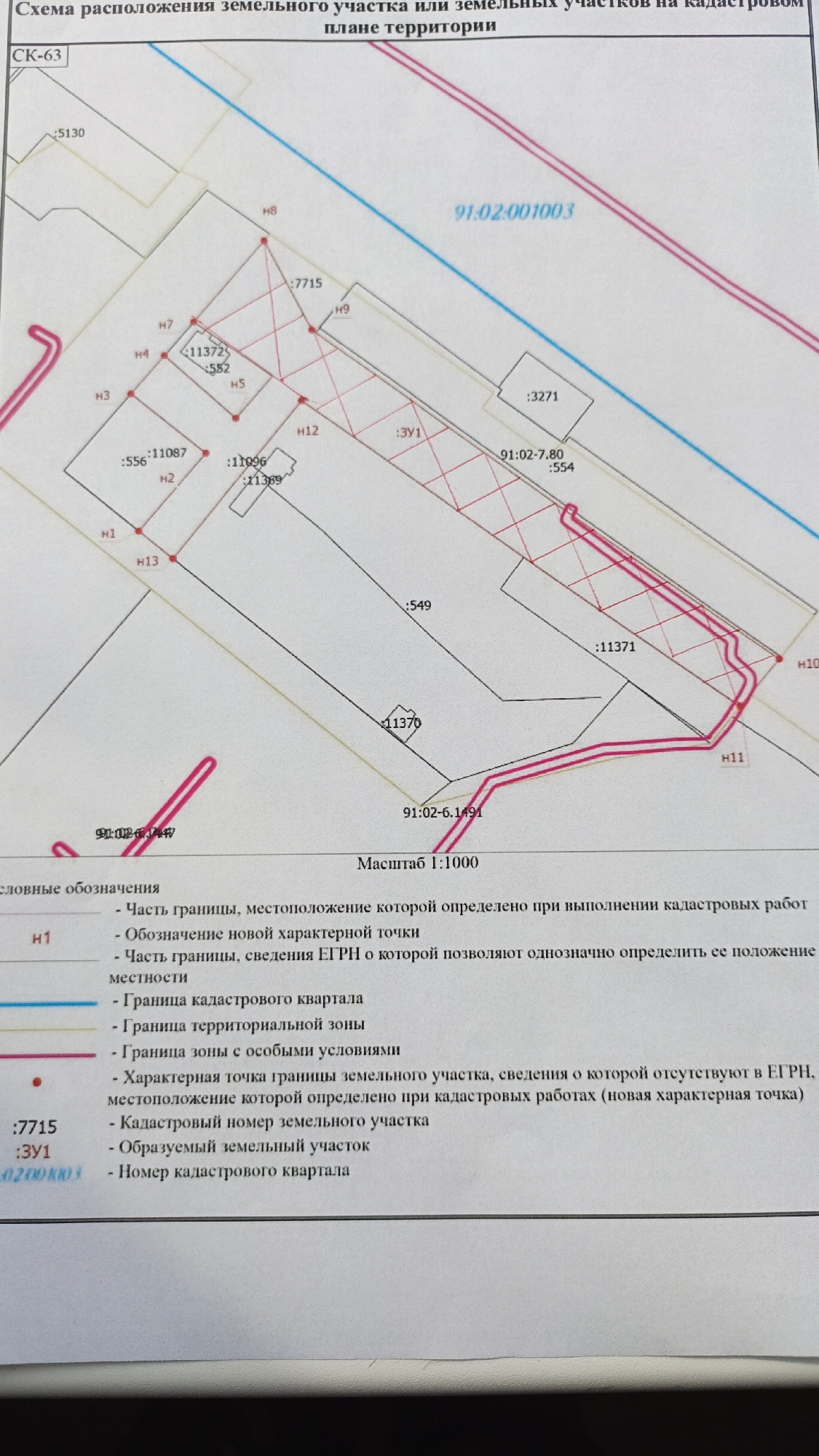
The image is a scanned document showing a cadastral plan for land plots, possibly located in Sevastopol, Ukraine, based on the potential connection to the "91" regional code.

The document includes the following details:

*   **Title:** "Scheme of location of a land plot or land plots on the cadastral plan of the territory"
*   **Scale:** 1:1000
*   **Cadastral Numbers:** Cadastral numbers are indicated on the plan, such as "91:02:001003" and "91:02-6.1491".
*   **Land Plots:** These are outlined on the plan, with numerical labels like ":7715" and ":3Y1" (potentially referring to "formed land plot").
*   **Boundary Points:** Designated with "H" followed by a number (e.g., "H1", "H2", "H3," etc.), indicating boundary points.
*   **Legends:** A legend explains the symbols used in the plan. These include different types of boundaries (cadastral quarter, territorial zone, special conditions zone), designations of new characteristic points, and details about boundary information.
*   **Other Numbers:** Other numbers, like ":5130", ":556", ":11087", are associated with specific points or lines on the cadastral plan.

The image provides a technical, schematic representation of land plots, cadastral divisions, and boundary information.
Nikolau026

May 20, 2026, 2:17 PM

Sevastopol, Ukraine

Moment

Stake attention in this memory

technical
informative
precise
official
analytical

The image is a scanned document showing a cadastral plan for land plots, possibly located in Sevastopol, Ukraine, based on the potential connection to the "91" regional code. The document includes the following details: * **Title:** "Scheme of location of a land plot or land plots on the cadastral plan of the territory" * **Scale:** 1:1000 * **Cadastral Numbers:** Cadastral numbers are indicated on the plan, such as "91:02:001003" and "91:02-6.1491". * **Land Plots:** These are outlined on the plan, with numerical labels like ":7715" and ":3Y1" (potentially referring to "formed land plot"). * **Boundary Points:** Designated with "H" followed by a number (e.g., "H1", "H2", "H3," etc.), indicating boundary points. * **Legends:** A legend explains the symbols used in the plan. These include different types of boundaries (cadastral quarter, territorial zone, special conditions zone), designations of new characteristic points, and details about boundary information. * **Other Numbers:** Other numbers, like ":5130", ":556", ":11087", are associated with specific points or lines on the cadastral plan. The image provides a technical, schematic representation of land plots, cadastral divisions, and boundary information.

Loading AttnAds…

transactions
revenues
stakers
Earliest
Latest
Highest stake

No transactions found

More from this user

More from Sevastopol

Nikolau026

May 20, 2026, 2:17 PM

Sevastopol, Ukraine

Licensed under Creative Commons Attribution 4.0 International License. You are free to share and adapt this content with proper attribution.