
Stake attention in this memory
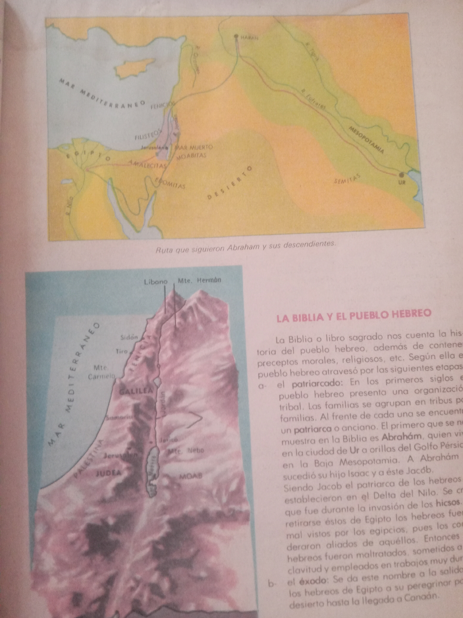
This media file features two maps and accompanying text, likely from an educational resource about biblical history. The top map illustrates the ancient Near East, depicting a route that Abraham and his descendants followed. Key locations such as the Mediterranean Sea, Mesopotamia, the Euphrates and Tigris rivers, Ur, and cities like Harran are labeled in Spanish. The path of Abraham's journey is highlighted with a red line. The bottom map focuses on the region of Palestine, detailing biblical territories and cities. It prominently displays the Mediterranean Sea, the Jordan River, and the Dead Sea. Labeled locations include Phoenicia, Galilee, Judea, Moab, and cities like Sidon, Tyre, Jerusalem, and Jericho. This map also appears to be in Spanish. The text below the maps, also in Spanish, discusses "The Bible and the Hebrew People." It describes the patriarchal period, mentioning Abraham, Isaac, and Jacob, and their migration to the Nile Delta. It also introduces the concept of the "Exodus," referring to the Hebrews' departure from Egypt and their journey through the desert to Canaan. The text mentions the Hicsos and their invasion of Egypt, as well as the mistreatment of the Hebrews by the Egyptians. The overall scene is one of historical and religious education, using maps to visualize ancient geography and text to explain key events and periods in Hebrew history. The style of the maps suggests they are from a printed book or publication, likely created in the mid to late 20th century. There are no visible indications of time of day, weather, or specific emotions displayed, as the focus is on factual representation of historical geography and events.
Loading AttnAds…
No transactions found