Stake attention in this memory
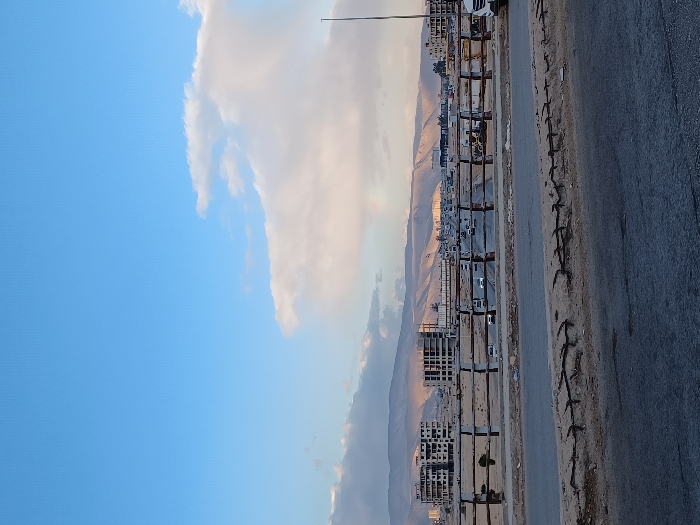
An elevated panoramic view in Zamalka, Syria, depicts a multi-lane highway bisecting an urban and semi-arid landscape under a partially cloudy, light blue sky. In the foreground, a weathered concrete barrier with exposed rebar extends horizontally, separating the viewer's position from the road below. A dark asphalt surface is visible immediately beneath this barrier. The midground features a brown and concrete railing spanning the frame, beyond which a multi-lane road carries vehicular traffic, including numerous cars and at least one white SUV partially visible on the far right. Adjacent to the road, an arid, sandy expanse gives way to several unfinished, multi-story concrete building skeletons on the left, indicative of ongoing construction or damage, and more developed urban structures to the right. In the background, a range of dry, rocky mountains stretches across the horizon, illuminated by an oblique light source, creating shadows and highlights. The sky above is largely clear blue on the left, transitioning to significant white and light grey cloud formations on the right. No individuals are distinctly visible, and no overt actions or interactions are discernible beyond vehicular movement.
No transactions found