Stake attention in this memory
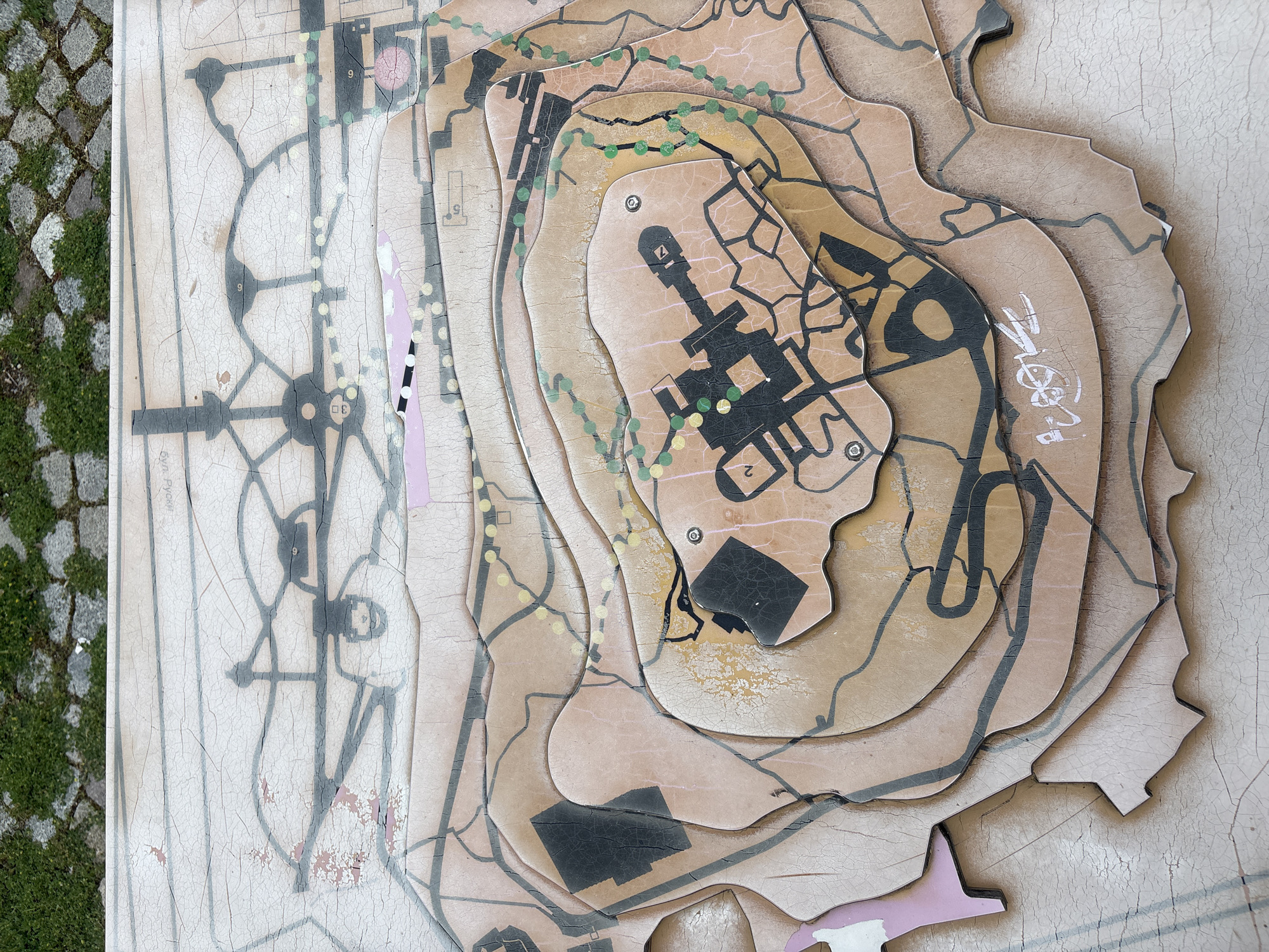
The image shows a multi-layered, topographic map of the "Bunardzhik" Hill in Plovdiv, Bulgaria. The map is situated outdoors, adjacent to a cobblestone walkway with grass in between the stones. The map itself appears to be constructed from multiple layers of material, likely wood or plastic, with each layer representing a different elevation. The layers are stacked on top of one another to create a three-dimensional representation of the hill's topography. The map includes details such as contours, roads, pathways (indicated by green dots), and possibly buildings or landmarks (represented by black shapes). Some areas of the map are marked with numbers, possibly indicating specific locations or points of interest. There are some minor damages on the map. The word "Пловдив" (Plovdiv in Bulgarian) is visible in white marker on the side.
No transactions found