Stake attention in this memory
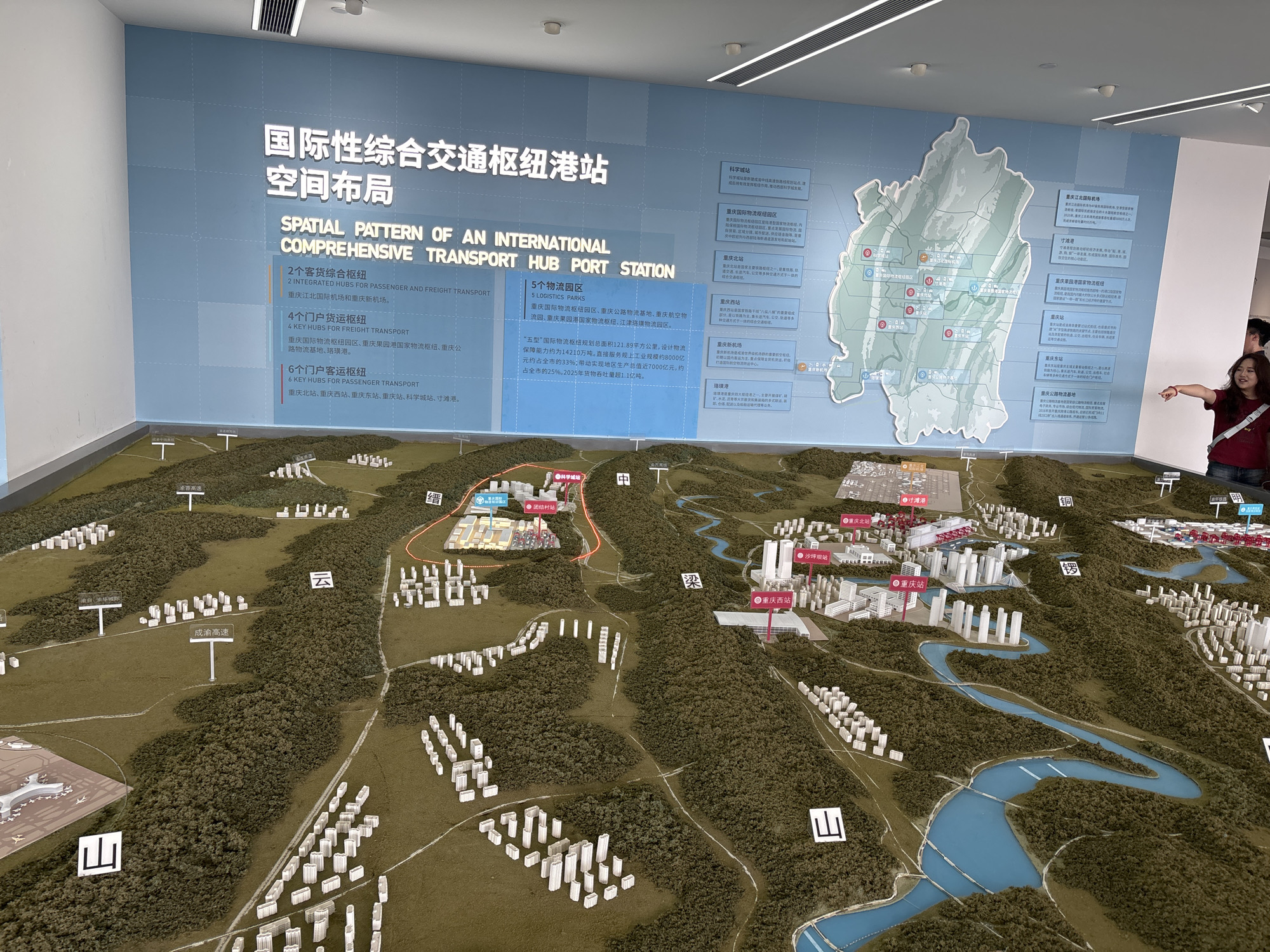
The image depicts a detailed architectural model of an urban transportation hub, likely located in Shapingba District, China, as indicated by labels on the model and accompanying signage. The model showcases a sprawling landscape with miniature buildings, roads, rivers, and topographical features, representing a complex urban and industrial area. A large blue wall display behind the model features Chinese and English text describing the "Spatial Pattern of an International Comprehensive Transport Hub Port Station" and lists key transport hubs and logistics parks. The model itself is illuminated from above, casting shadows on its textured surface. In the foreground, a section of the model includes an airport with airplanes on the tarmac, a residential area with numerous small white buildings, and a major highway labeled "成渝高速" (Chengdu-Chongqing Expressway). Further into the model, more dense urban areas with taller buildings are visible, along with a winding blue river that traverses the landscape. Several red circular markers with white dots are placed on the model, likely indicating specific transportation nodes. To the right of the model, a portion of a woman wearing a red shirt is visible, pointing towards the display. The overall scene is an informative exhibit of urban planning and transportation infrastructure.
No transactions found

