
Sign in
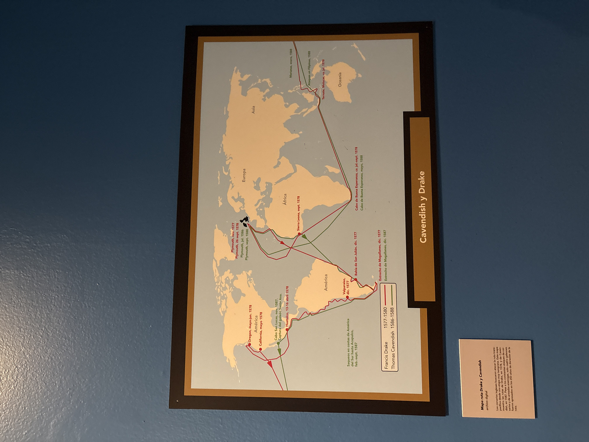
The image shows a framed map titled "Cavendish y Drake" hanging on a light blue wall, possibly in a museum or educational setting, potentially in Mexico City, Mexico. The map outlines the routes taken by Francis Drake (1577-1580) and Thomas Cavendish (1586-1588) during their voyages, with red lines indicating Drake's route and green lines showing Cavendish's route. The map includes locations like Plymouth, Sierra Leona, Cape of Good Hope, the Strait of Magellan, California, and the Philippines. Beside the framed map is a smaller card providing information about Drake and Cavendish's routes, explaining that English corsairs sought to attack the transpacific route from a very early stage.
Tamara

Apr 3, 2026, 6:24 PM

Mexico City, Mexico

Stake attention in this memory

Exploration
Adventure
Historical
Curiosity
Nostalgia

The image shows a framed map titled "Cavendish y Drake" hanging on a light blue wall, possibly in a museum or educational setting, potentially in Mexico City, Mexico. The map outlines the routes taken by Francis Drake (1577-1580) and Thomas Cavendish (1586-1588) during their voyages, with red lines indicating Drake's route and green lines showing Cavendish's route. The map includes locations like Plymouth, Sierra Leona, Cape of Good Hope, the Strait of Magellan, California, and the Philippines. Beside the framed map is a smaller card providing information about Drake and Cavendish's routes, explaining that English corsairs sought to attack the transpacific route from a very early stage.

Loading AttnAds…

transactions
revenues
stakers
Earliest
Latest
Highest stake

No transactions found

More from this user

More from Mexico City

Tamara

Apr 3, 2026, 6:24 PM

Mexico City, Mexico

Licensed under Creative Commons Attribution 4.0 International License. You are free to share and adapt this content with proper attribution.