Stake attention in this memory
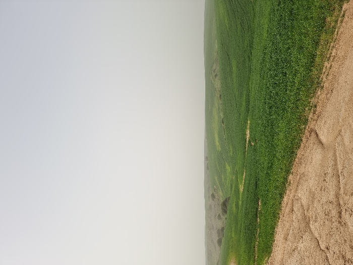
The image depicts an agricultural landscape within the Shaar HaNegev Regional Council, Israel, under conditions of significant atmospheric haze or overcast sky. In the foreground, a light brown dirt path, exhibiting cracks and an irregular texture, traverses from the lower left toward the right edge of the frame. Adjacent to this path, a vast field of dense, vibrant green vegetation, consistent with agricultural crops, covers undulating terrain that recedes into a gentle valley. A faint lighter-colored track or depression is observable winding through the green field in the mid-distance. In the background, low, irregular hills sparsely covered with darker green scrub are present, their features softened by the prevailing haze. The sky is a uniform, pale grey-white, blending seamlessly with the distant horizon and limiting visibility of fine details. No individuals, animals, or structures are visible.
Loading AttnAds…
No transactions found