Stake attention in this memory
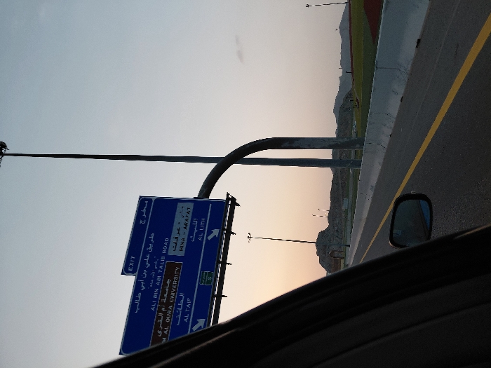
The image, taken from the perspective of a vehicle, is rotated 90 degrees clockwise, showing a view from a road at what appears to be either sunrise or sunset. The sky transitions from a light blue at the top to a warm, peachy orange near the horizon. In the immediate foreground, part of a car's dark interior, possibly the dashboard or door, is visible along the bottom edge, with a side mirror reflecting the road behind it. The main focus of the image is a large blue overhead road sign positioned to the left of the frame. The sign displays white text in both Arabic and English, indicating directions. The visible text includes: * "EXIT" * "طريق علي بن أبي طالب" (Ali Bin Abi Talib Road) * "ALI BIN ABI TALIB ROAD" (OCR incorrectly transcribed "ABM" for "ABI") * "جامعة أم القرى" (Umm Al-Qura University) * "UMM AL QURA UNIVERSITY" (OCR incorrectly transcribed "MAL" for "UMM") * "الطائف" (Al Taif) * "AL TAIF" * Below these, another section of the sign indicates: * "مخرج" (Exit) * "منى - عرفات" (Mina - Arafat) * "MINA ARAFAT" * "الليث" (Al Lith) * "AL LITH" There is also a small green sign with a white "S" and a number, likely indicating a route number. To the right of the sign, a tall, dark street light or utility pole extends upwards. Further right, a concrete barrier separates the highway from an adjacent area that appears to be a field or track, possibly part of a sports complex or stadium, with visible green and reddish-brown sections. In the background, low-lying mountains or hills are silhouetted against the colorful sky. The asphalt road itself has a clear yellow lane marking. The overall scene suggests travel on a multi-lane highway in a desert or semi-arid region, likely in Saudi Arabia given the place names mentioned on the sign.
No transactions found