Stake attention in this memory
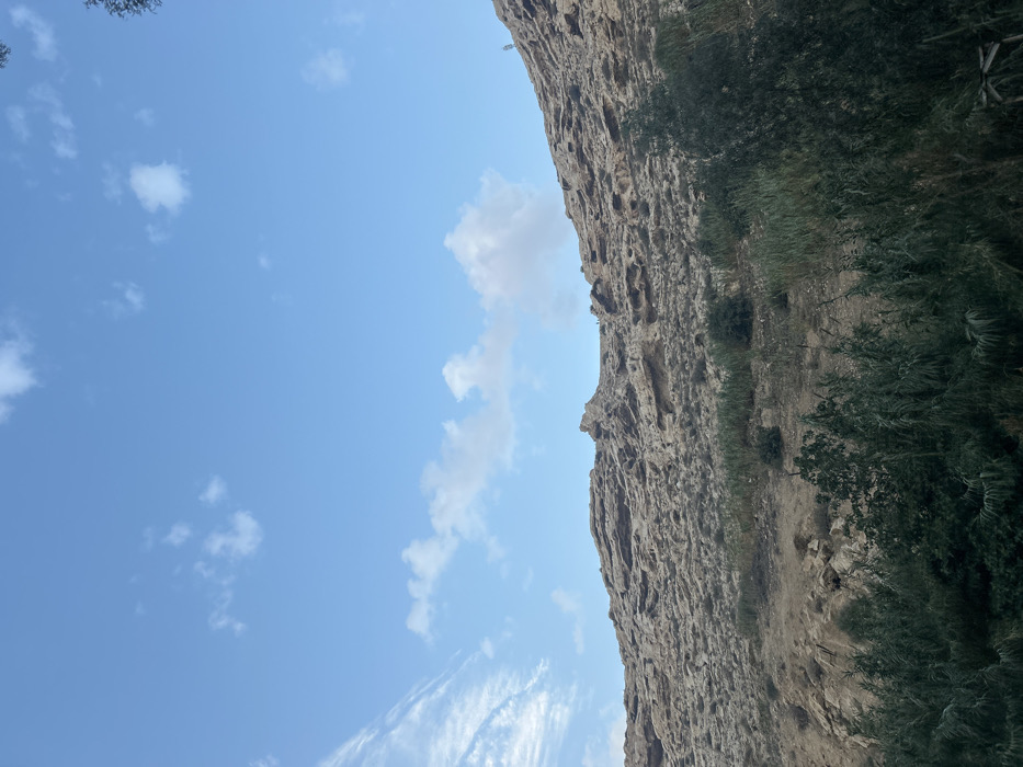
The image displays a natural landscape within Dummar Municipality, Syria. A large, rugged, light brown rock formation or hill dominates the middle ground and upper right. Its surface is characterized by irregular textures, indentations, and weathered rock outcrops. The foreground is densely covered with dark green vegetation, consisting primarily of tall, slender, reed-like plants and some broader-leafed shrubs. Patches of sparse, lighter green vegetation and dry earth are visible on the lower slopes of the rock formation. The upper portion of the scene features a clear blue sky with scattered white cumulus clouds and a streak of wispy cirrus clouds in the upper left quadrant. On the crest of the rocky hill, towards the right, several small, dark, indistinct forms are visible, consistent with human figures, along with a slender, dark vertical structure, possibly a utility pole or antenna. No explicit actions or interactions are discernible.
Symbol
25BF4
Volume
8,469
Creator
+$0.07
Revenue
+$0.00
TVL
$7.13