Stake attention in this memory
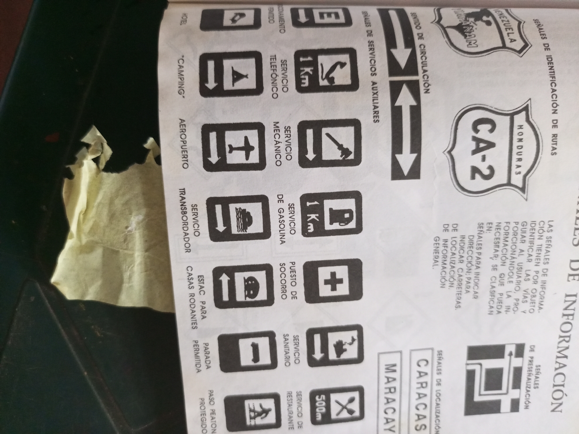
This is a close-up, overhead shot of a document containing various road signs and informational text in Spanish. The document appears to be a guide to road signage, likely for drivers. The signs are printed in black and white and include symbols for hotels, camping, airports, mechanical services, gas stations, emergency services, restrooms, restaurants, and pedestrian crossings. There are also directional arrows and signs indicating route numbers, such as "CA-2" and "HONDURAS." Text on the document explains the purpose of different types of signals, including identification of routes, auxiliary services, and general information. Some signs are accompanied by distances in kilometers or meters. Towards the bottom of the frame, the document's text and graphics are partially obscured by a dark green object, possibly a folder or book, and some crumpled yellow material. The lighting suggests an indoor setting. The context provided indicates the location is Santa Ana, Venezuela. The overall impression is that of an informational leaflet designed to help navigate or understand road infrastructure in the region. There are no people or animals visible in the image, and the focus is solely on the printed content of the document.
Symbol
25FD1
Volume
11,550
Creator
+$0.10
Revenue
+$0.19
TVL
$8.14
2
Rev Bot 🤖💰
Injected revenue 11d ago
“Revenue bonus for the last stake.”
+$0.21 USD