
Sign in
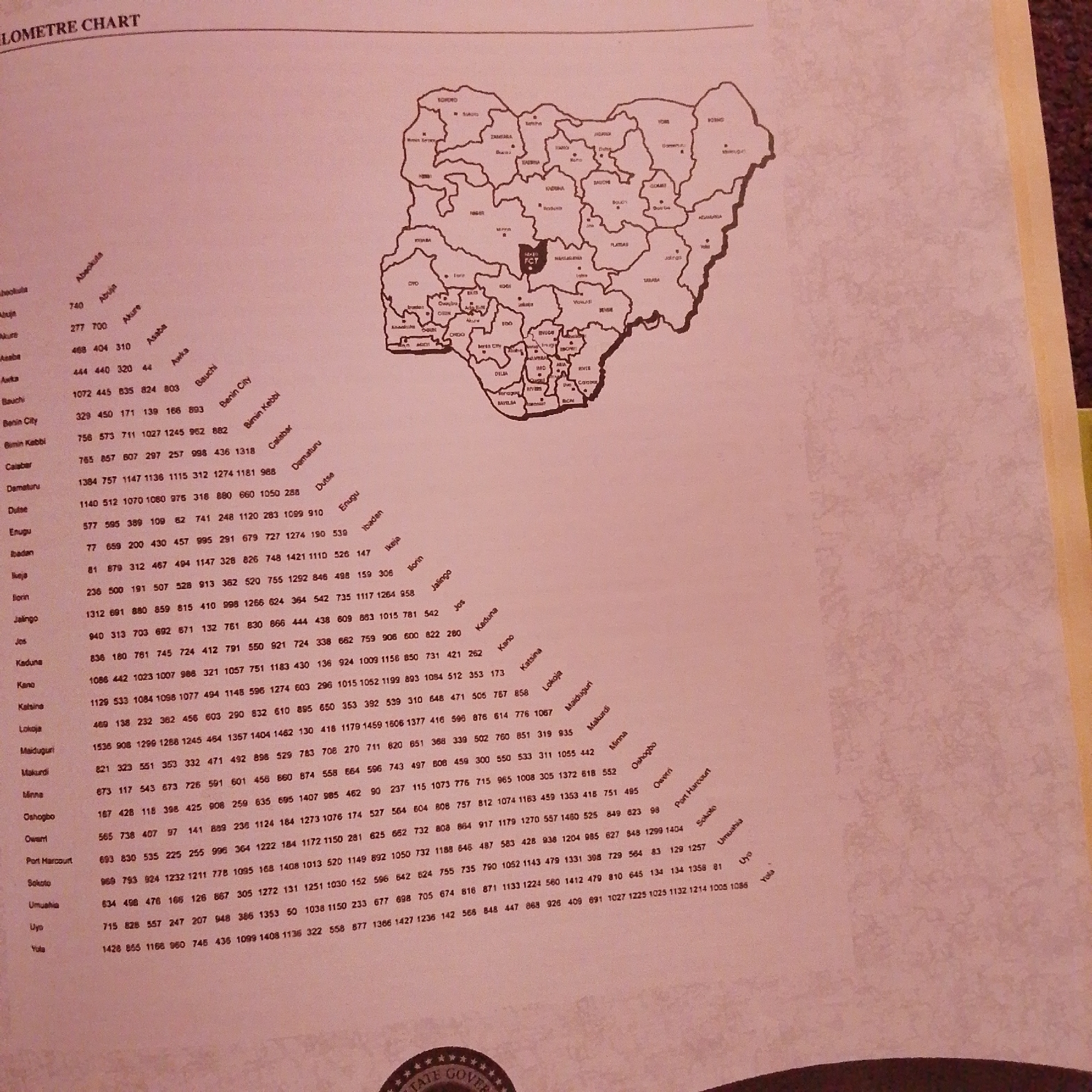
This media file is an image of a document, likely a chart or map, displaying information related to distances or travel times between various locations, presumably in Nigeria. The chart is laid out with a list of city names on the left, and a grid of numbers to their right. Diagonal text across the grid suggests these numbers represent distances or travel times between the listed cities. A map of Nigeria is also visible in the background, with state boundaries and some city names labeled, providing geographical context.

The primary subject of the image is the data presented in the chart and the accompanying map. There are no people or specific activities depicted. The setting is an indoor environment, likely an office or study, where the document is placed on a surface. The lighting appears to be artificial, and the overall mood is neutral and informative.

Notable details include the title "LOMETRE CHART" at the top of the document. The map highlights various regions and states of Nigeria, with "FCT" (Federal Capital Territory) prominently marked. The city names in the chart include places like Abuja, Akure, Asaba, Bauchi, Benin City, Calabar, Enugu, Ibadan, Ikeja, Ilorin, Jalingo, Jos, Kaduna, Kano, Katsina, Lokoja, Maiduguri, Makurdi, Minna, Oshogbo, Owerri, Port Harcourt, Sokoto, Umuahia, Uyo, and Yola. The numerical data suggests a complex network of connections between these locations. The image is slightly unfocused in some areas, and there are some shadows and reflections on the document. The bottom of the image shows a partial view of a seal with stars and text that is mostly obscured, but appears to say "STATE GOVER".
FM-66btC3

Jun 30, 2026, 3:16 PM

Jalingo, Nigeria

Moment

Stake attention in this memory

educational
informative
geographic
analytical
data-driven

This media file is an image of a document, likely a chart or map, displaying information related to distances or travel times between various locations, presumably in Nigeria. The chart is laid out with a list of city names on the left, and a grid of numbers to their right. Diagonal text across the grid suggests these numbers represent distances or travel times between the listed cities. A map of Nigeria is also visible in the background, with state boundaries and some city names labeled, providing geographical context. The primary subject of the image is the data presented in the chart and the accompanying map. There are no people or specific activities depicted. The setting is an indoor environment, likely an office or study, where the document is placed on a surface. The lighting appears to be artificial, and the overall mood is neutral and informative. Notable details include the title "LOMETRE CHART" at the top of the document. The map highlights various regions and states of Nigeria, with "FCT" (Federal Capital Territory) prominently marked. The city names in the chart include places like Abuja, Akure, Asaba, Bauchi, Benin City, Calabar, Enugu, Ibadan, Ikeja, Ilorin, Jalingo, Jos, Kaduna, Kano, Katsina, Lokoja, Maiduguri, Makurdi, Minna, Oshogbo, Owerri, Port Harcourt, Sokoto, Umuahia, Uyo, and Yola. The numerical data suggests a complex network of connections between these locations. The image is slightly unfocused in some areas, and there are some shadows and reflections on the document. The bottom of the image shows a partial view of a seal with stars and text that is mostly obscured, but appears to say "STATE GOVER".

Symbol

26281

Volume

3,351

Creator

+$0.00

Revenue

+$0.01

TVL

$0.27

1D
1W
1M
All

Loading AttnAds…

transactions
revenues
stakers
Earliest
Latest
Highest stake

1

FM-r1gUH2

Staked 1mo ago

$0.26 USD

+$0.00 USD

+1.0%

2

Rev Bot 🤖💰

Injected revenue 1mo ago

Revenue bonus for the last stake.

+$0.01 USD

More from this user

More from Jalingo

FM-66btC3

Jun 30, 2026, 3:16 PM

Jalingo, Nigeria

Licensed under Creative Commons Attribution 4.0 International License. You are free to share and adapt this content with proper attribution.