Stake attention in this memory
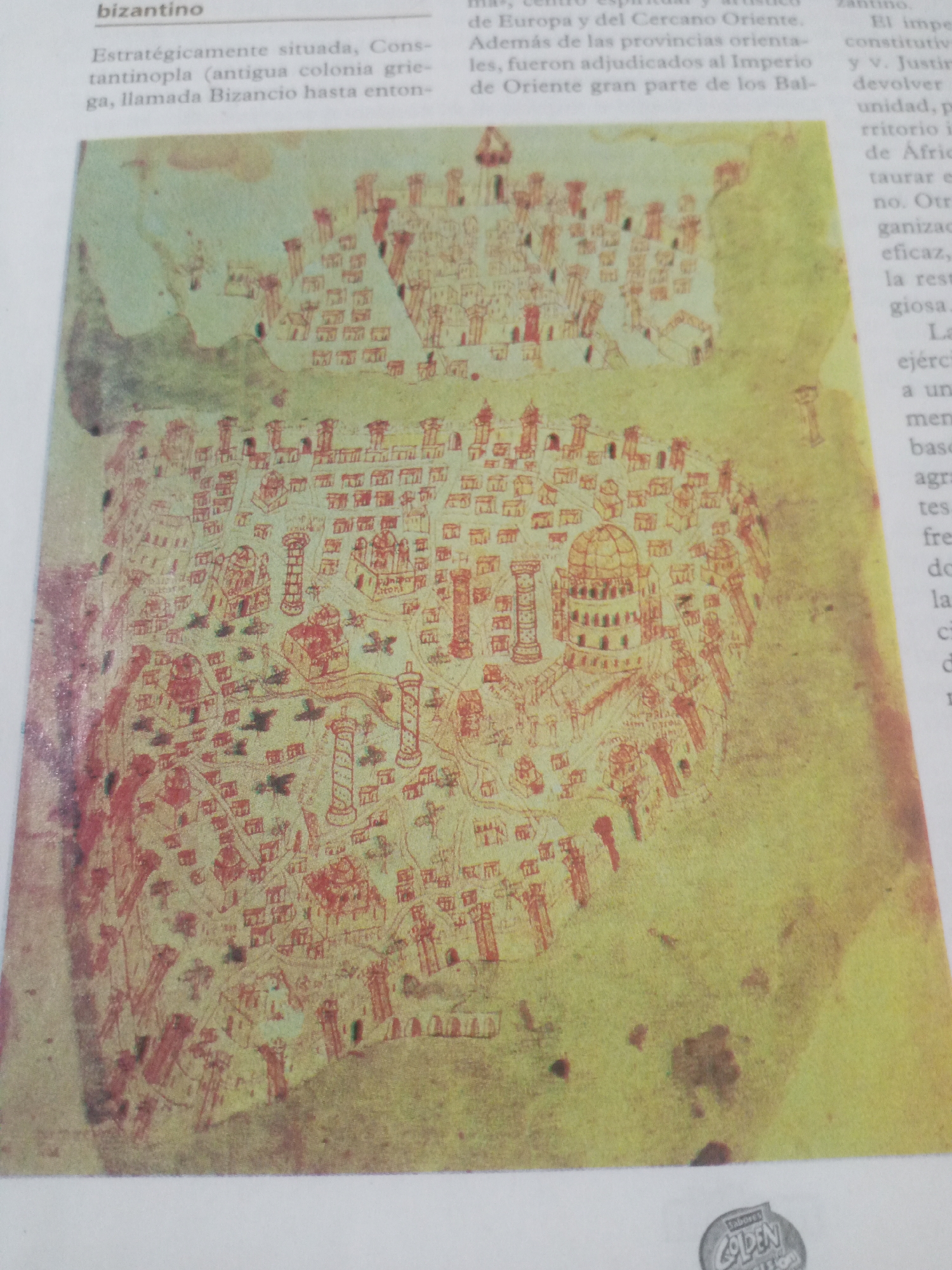
This media file is an image of an old map, likely a historical illustration. The map is drawn in red and yellow hues, with intricate details of buildings, walls, and possibly roads or rivers. It appears to depict a city or region with numerous structures, some resembling towers and domes, characteristic of ancient architecture. The map's style suggests it is a hand-drawn artifact, possibly from a book or document. The visible text indicates the map is related to the "bizantino" (Byzantine) era. It mentions "Constantinopla" (Constantinople), its former name "Bizancio" (Byzantium), and its strategic location connecting Europe and the Near East. The text also refers to eastern provinces and the Balkan regions being part of the "Imperio de Oriente" (Eastern Empire). The mention of "ejército" (army) and "organizacion eficaz" (effective organization) suggests a context of historical governance or military activity. The image also contains a small, circular logo at the bottom, which appears to be a brand or product label, possibly reading "Sabores GOLDEN". This detail, along with the presence of text related to Venezuela in the prompt's location context, might suggest the map is reproduced in a Venezuelan publication. The overall scene is that of a historical document or representation, not a snapshot of current activity. The map itself, with its detailed drawings, is the primary subject. There are no people or animals depicted on the map. The setting is implied to be a historical location, likely Constantinople or a region under Byzantine influence. The lighting suggests it is an indoor photograph of a printed page.
Symbol
26DA1
Volume
11,550
Creator
+$0.17
Revenue
+$0.24
TVL
$14.75
2
Rev Bot 🤖💰
Injected revenue 1d ago
“Revenue bonus for the last stake.”
+$0.26 USD