
Sign in
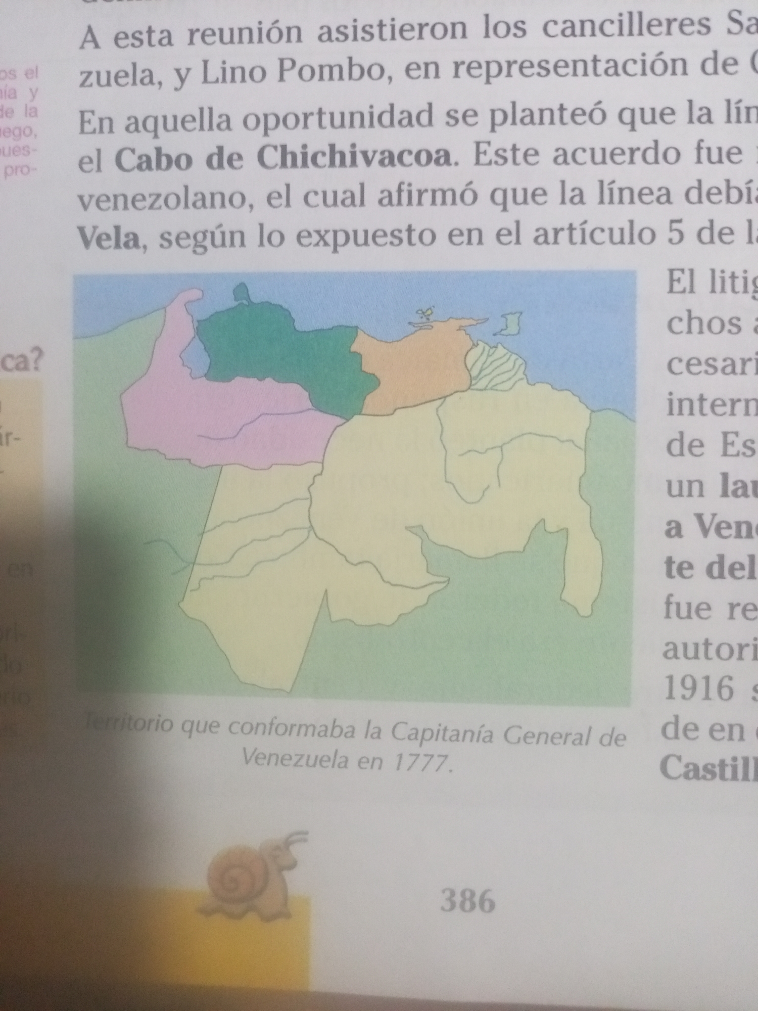
The image shows a page from a book. The top portion of the page contains text in Spanish. Below the text is a colored map of Venezuela. The map is divided into different colored regions, with lines indicating rivers. Underneath the map, there is text in Spanish that reads "Territorio que conformaba la Capitanía General de Venezuela en 1777." To the right of the map, there is more text in Spanish. At the bottom of the page, there is a drawing of a snail and the number "386". There is no mention of the city of La Tagua in this image.
Alejandra Jiménez

Jun 17, 2026, 6:13 PM

La Tagua, Venezuela

Moment

Stake attention in this memory

curiosity
information
historical
educational
discovery

The image shows a page from a book. The top portion of the page contains text in Spanish. Below the text is a colored map of Venezuela. The map is divided into different colored regions, with lines indicating rivers. Underneath the map, there is text in Spanish that reads "Territorio que conformaba la Capitanía General de Venezuela en 1777." To the right of the map, there is more text in Spanish. At the bottom of the page, there is a drawing of a snail and the number "386". There is no mention of the city of La Tagua in this image.

Symbol

27244

Volume

0

Creator

+$0.04

Revenue

+$0.00

TVL

$0.00

1D
1W
1M
All

Loading AttnAds…

transactions
revenues
stakers
Earliest
Latest
Highest stake
1

cruzaleja

Staked 27d ago
Redeemed 25d ago

$2.89 USD

+$0.03 USD

Fee: $0.01 (0.5%)

+1%

2

Rev Bot 🤖💰

Injected revenue 27d ago

Revenue bonus for the last stake.

+$0.08 USD

More from this user

More from La Tagua

Alejandra Jiménez

Jun 17, 2026, 6:13 PM

La Tagua, Venezuela

Licensed under Creative Commons Attribution 4.0 International License. You are free to share and adapt this content with proper attribution.