Stake attention in this memory
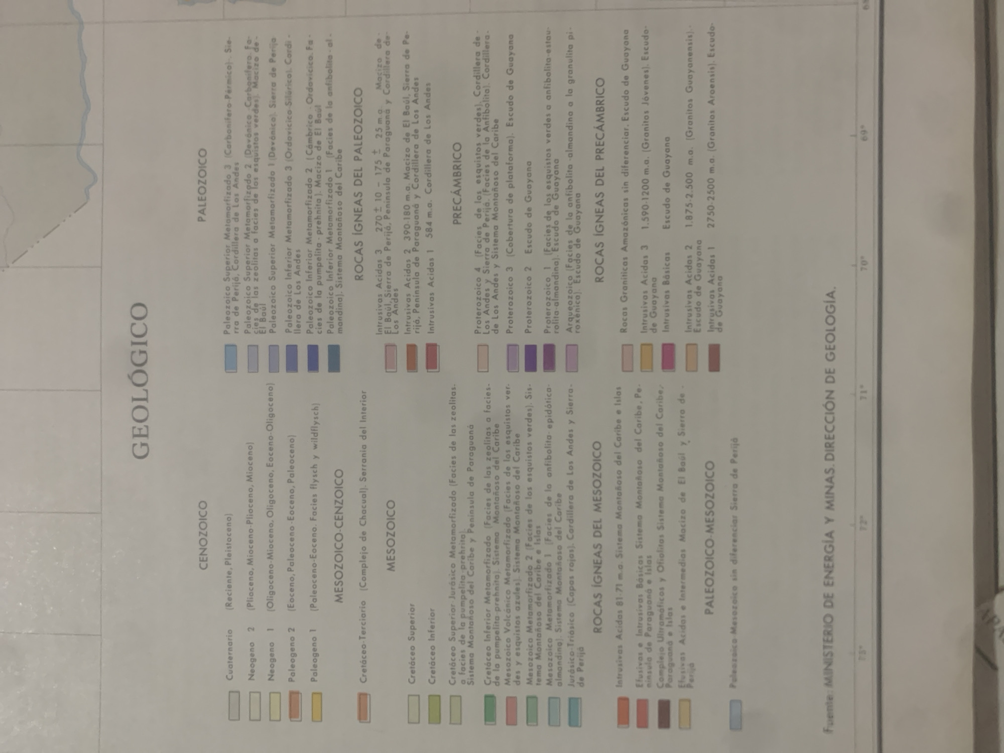
The image is a close-up, angled shot of a geological map legend. The legend displays various geological eras and periods, with corresponding color swatches and descriptions of rock types and formations. The subjects are purely informational, presented as text and color-coded blocks. There are no people, animals, or objects in the traditional sense. The scene is a section of a map, likely in a document or a presentation, focused on a detailed legend. The setting is professional and technical, dealing with geological classification. The activity taking place is the presentation of scientific data in the form of a legend, allowing for the interpretation of a geological map. There is no discernible time of day or weather as this is a representation of information, not a real-world scene. The location cues are embedded within the text itself, referring to geological features like "Cordillera de Los Andes," "Sistema Montañoso del Caribe," "Macizo de El Baúl," and "Escudo de Guayana." Notable details include the chronological ordering of geological periods from Cenozoic to Precambrian, and specific rock classifications like "Intrusivas Acidas," "Facies de los esquistos verdes," and "Complejo Ultramaficas y Ofiolitas." The text is in Spanish. The legend is presented as a key to understanding a larger geological map, likely related to Venezuela due to the location cues. There are no visible emotions. The visible text is extensive and forms the core of the image, detailing geological terms and timelines.
Symbol
27359
Volume
11,550
Creator
+$0.13
Revenue
+$0.16
TVL
$11.59
2
Rev Bot 🤖💰
Injected revenue 6d ago
“Revenue bonus for the last stake.”
+$0.17 USD


