Sign in
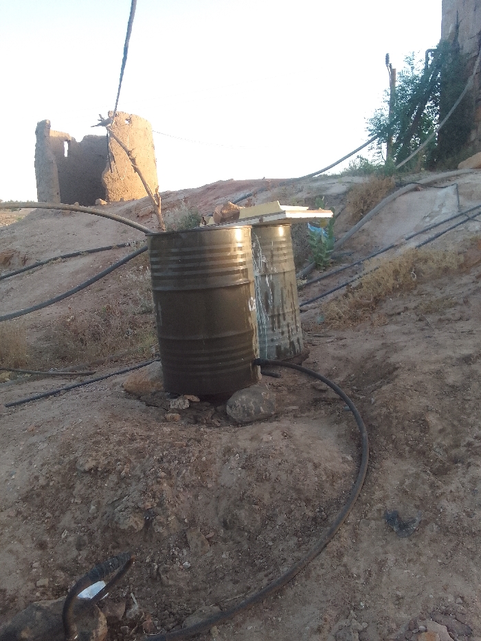
The image shows two large metal barrels, likely used for water storage, positioned next to a mud brick building in a rural area. The building, partially destroyed, has a flat roof and is made of mud bricks. The ground surrounding the building is bare and dusty, with a few sparse plants and shrubs. The barrels are connected to a system of black plastic hoses, suggestive of a water irrigation system. The scene is in Samareit, Sudan, located at the coordinates 18.376° N, 31.755° E. The sky is a pale blue with a hint of orange near the horizon, indicating a late afternoon or early evening time. The image likely captures a moment in the daily life of this rural community, highlighting their resourceful use of water and their resilience in a dry environment.
FM-yC96M2

Apr 27, 2025, 3:41 PM

Samareit, Sudan

Stake attention in this memory

rustic
dry
abandoned
simple
remote

The image shows two large metal barrels, likely used for water storage, positioned next to a mud brick building in a rural area. The building, partially destroyed, has a flat roof and is made of mud bricks. The ground surrounding the building is bare and dusty, with a few sparse plants and shrubs. The barrels are connected to a system of black plastic hoses, suggestive of a water irrigation system. The scene is in Samareit, Sudan, located at the coordinates 18.376° N, 31.755° E. The sky is a pale blue with a hint of orange near the horizon, indicating a late afternoon or early evening time. The image likely captures a moment in the daily life of this rural community, highlighting their resourceful use of water and their resilience in a dry environment.

Loading AttnAds…

transactions
revenues
stakers
Earliest
Latest
Highest stake

No transactions found

More from this user

More from Samareit

FM-yC96M2

Apr 27, 2025, 3:41 PM

Samareit, Sudan

Licensed under Creative Commons Attribution 4.0 International License. You are free to share and adapt this content with proper attribution.